County

Monaghan

Muineachán

Monaghan’s older regional identity and its parish geography connect it closely with neighbouring parts of Ulster and Leinster.

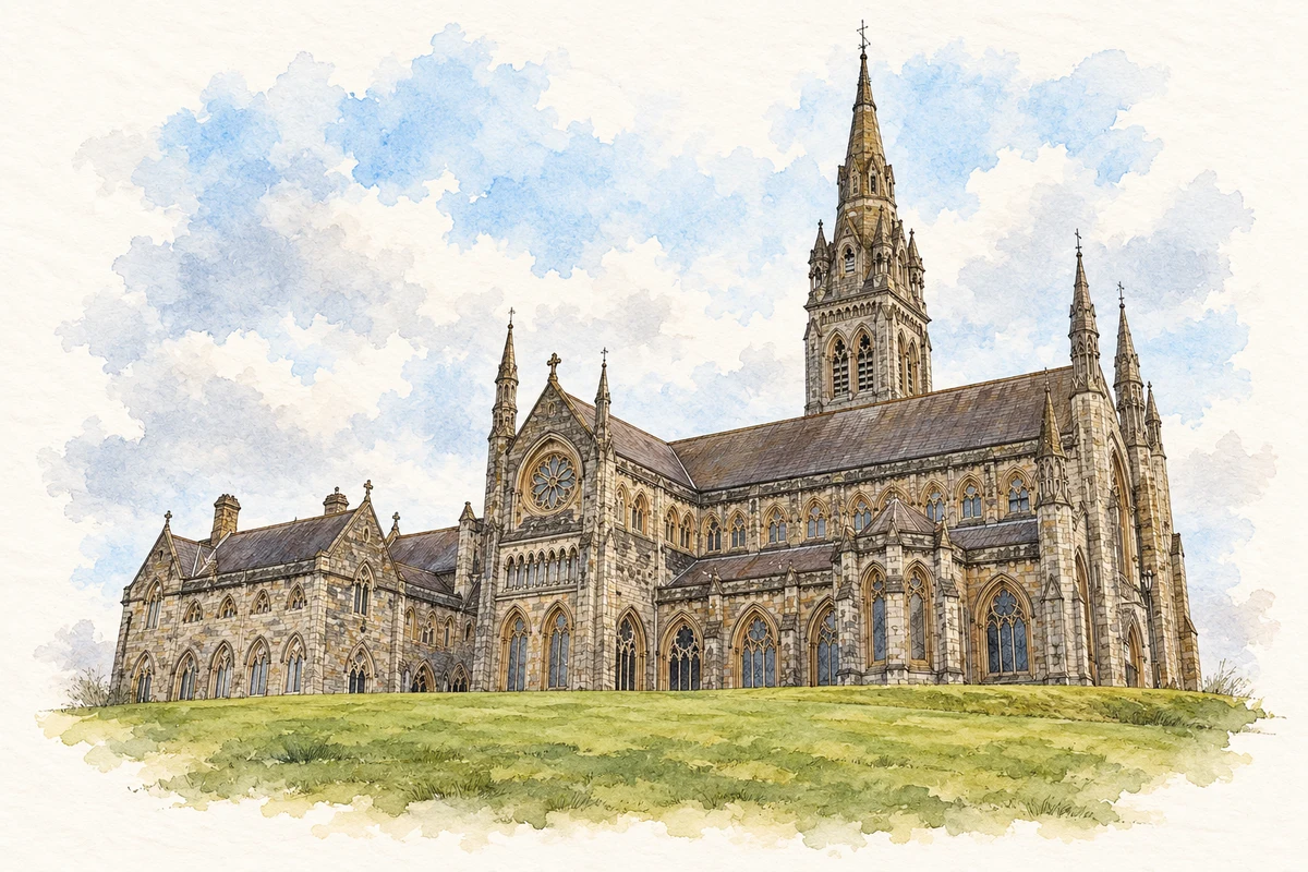
Watercolour and fine ink illustration of St Macartan’s Cathedral, Monaghan in County Monaghan.
Illustration, St Macartan’s Cathedral, Monaghan
Recorded locationMonaghan54.16304° N · 6.95338° WInteractive map supplied by OpenStreetMap.
Recorded place location · Logainm.ie

The name

A reliable full-name meaning has not been established here. The recorded Irish and English forms are given without an unsupported translation.

Recorded forms

  • Muineachán · Irish · main form · validated name
  • Monaghan · English · main form

Place & story

An inland meeting of counties

Lewis’s 1837 opening places Monaghan between Louth and Armagh on one side, Fermanagh and Cavan on the other, with Tyrone to the north and Meath to the south. A family’s nearest town or institution might lie outside the county named in a later postal address. [2]

Oriel and MacMahon country

The directory records Oriel, Uriel and Orgial as historical regional forms extending beyond Monaghan into neighbouring counties. It also associates much of the county’s political history with the MacMahons. Lewis’s proposed monk-related explanation of the county town’s name is not adopted as a definitive etymology here, and a local surname does not supply a personal pedigree. [2]

People & connections

Patrick Kavanagh’s Inniskeen

Patrick Kavanagh was born in the Inniskeen district in 1904 and spent the first thirty-five years of his life there. Farming, shoemaking and the lanes around his home supplied material for writing that gave ordinary rural experience an unusual literary intensity. [3]

In a 1966 RTÉ documentary, Kavanagh returned to his birthplace and the national school at Kednaminsha. He read from Tarry Flynn and discussed the road and neighbouring landscape associated with his work. The surviving film offers his own account of the relationship between place and imagination. It is also a useful corrective to a sentimental picture of an uncomplicated homecoming: in another excerpt he describes an ambivalent relationship with Inniskeen and the excitement he found elsewhere. [3] [4]

Geographic information

Place type
County
County
Monaghan
Coordinates
54.16304, -6.95338
Mapped area
1,294.49 km²
Logainm ID
100025 ↗

Population over time

County Monaghan, including its cities

County population, 1841–2022

65,288people · 2022

075K150K225K300K 1841: 200,442 people18411851: 141,823 people1861: 126,482 people1871: 114,969 people1881: 102,748 people1891: 86,206 people1901: 74,611 people19011911: 71,455 people1926: 65,131 people1936: 61,289 people1946: 57,215 people1951: 55,345 people19511956: 52,064 people1961: 47,088 people1966: 45,732 people1971: 46,242 people1979: 50,376 people1981: 51,192 people1986: 52,379 people1991: 51,293 people1996: 51,313 people2002: 52,593 people2006: 55,997 people2011: 60,483 people2016: 61,386 people2022: 65,288 people2022

Figures cover the whole county including its cities. CSO recommends this series for long-term comparison, although minor boundary changes have occurred.

View population figures
County Monaghan, including its cities — census population
Census yearPopulation
1841200,442
1851141,823
1861126,482
1871114,969
1881102,748
189186,206
190174,611
191171,455
192665,131
193661,289
194657,215
195155,345
195652,064
196147,088
196645,732
197146,242
197950,376
198151,192
198652,379
199151,293
199651,313
200252,593
200655,997
201160,483
201661,386
202265,288

Source: CSO F1001 — Population at Each Census. CC BY 4.0. Retrieved 2026-10-25.

People & family history

Census figures refer to the matched historical census area for each year. Boundaries and spellings can change over time.

Explore this county

Up to 50 places per page, ordered by name.

Sources & further reading

  1. Logainm.ie — Monaghan. Place names and geographic record, licensed under CC BY 4.0.
  2. County Monaghan — A Topographical Dictionary of Ireland (1837)
  3. And There Ended My Formal Learnin — RTÉ Archives, 1966
  4. Patrick Kavanagh’s Home Place — RTÉ Archives, 1966
  5. Boundary geometry retains its source attribution and licence in the downloadable geographic record. Map tiles © OpenStreetMap contributors.
  6. St Macartan’s Cathedral, Monaghan illustration: based on a reference by David Hillas. AI-assisted watercolour and ink adaptation; cream paper margins added, incidental clutter omitted and fine details simplified. Licence: CC BY-SA 2.0.

Name record retrieved 2026-10-25 · Source record modified 2025-01-10. How this page was prepared.