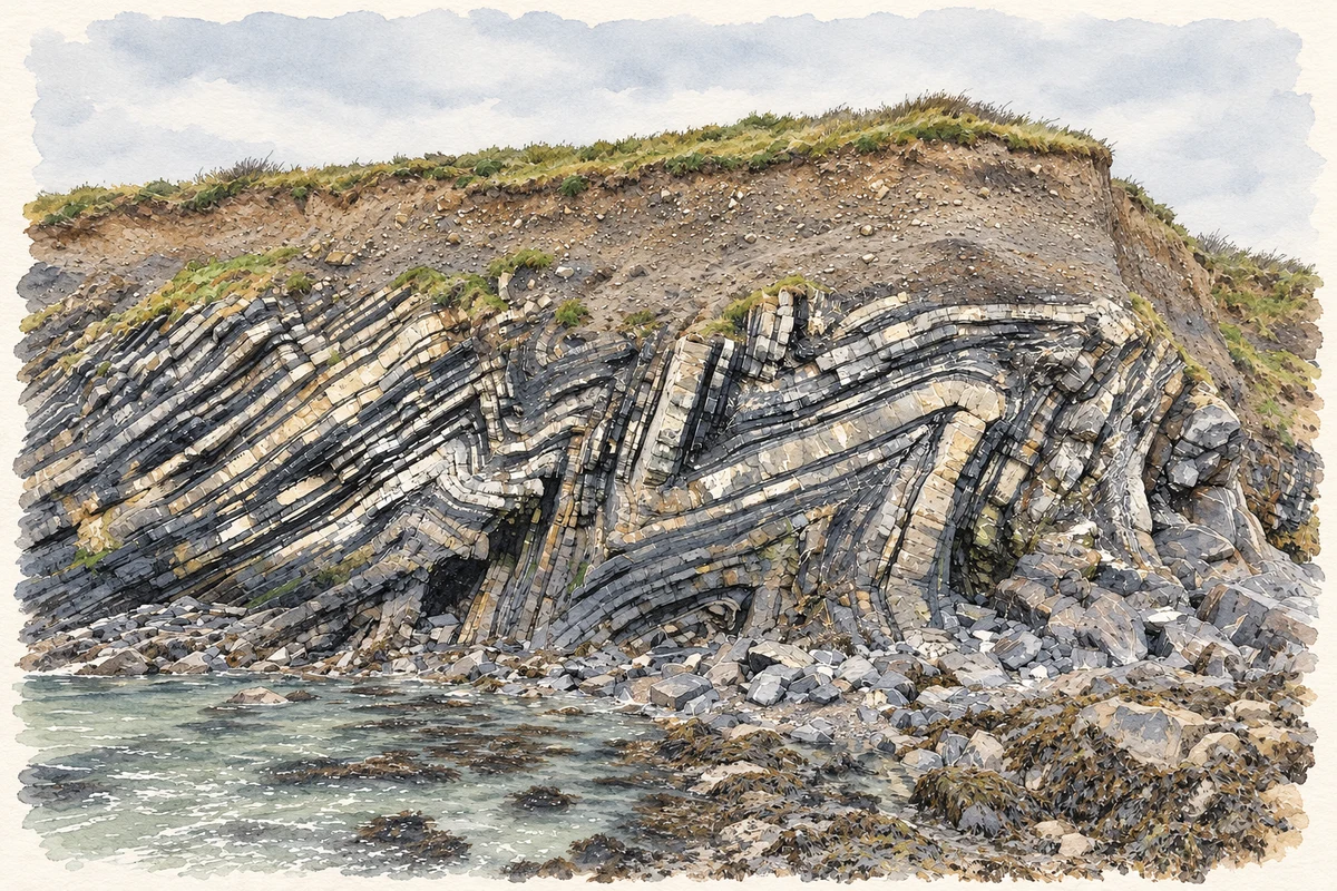
Loughshinny’s harbour lies beside striking rock folds and former mine workings, a landscape that has also generated cautionary stories about what lies below the ground.
Illustration, Folded coastal rocks at Loughshinny
⊕Recorded locationLoughshinny53.54650° N · 6.09498° WInteractive map supplied by OpenStreetMap.
These Irish name elements are associated with this record in the Logainm glossary.
An element’s translation is a clue, rather than a complete explanation of the name. Its form and meaning depend on local history and the full Irish name.
Recorded forms
Loch Sionnaigh· Irish · main form · validated name
Loughshinny· English · main form
Place & story
The folds beside the harbour
Geologist Matthew Parkes describes the coast between Skerries and Rush as a long sequence of Lower Carboniferous rocks. At Loughshinny, compression has bent the layered beds into conspicuous zigzags, known as chevron folds. Some can be seen both in the cliff face and across the exposed foreshore, revealing their shape in three dimensions. These structures are part of the area's geological record, not decorative patterns cut by people. The coastline brings processes that usually require a quarry face or specialist diagram into view beside a familiar fishing harbour.[2]
Copper and the cave’s other history
The opening known as the Smuggler's Cave north of the harbour is also associated with copper mining. Parkes records substantial workings in 1807–08, while Fingal County Council's account traces earlier mining investment to Martin O'Connor in 1760 and later changes of ownership. The ventures eventually ceased to be profitable. The industrial history gives the cave a different context from its popular name: mineral extraction helped shape the underground space and left traces in the surrounding landscape. The surviving workings are part of Loughshinny's history of labour as well as its coastal scenery.[2][3]
Folklore & tradition
The disappearing ploughman
Fingal's heritage account records a tale of a man ploughing a field who suddenly vanishes as the ground gives way beneath him. Local historian George Pratt discussed that story alongside a reported garden collapse in 1961 and suggested a connection with hidden mine shafts. The comparison is an interpretation of the tradition, not proof that the legendary incident happened as told. It shows how memories of unstable ground and abandoned workings could become a memorable local warning, carried in a story about an ordinary day's work unexpectedly interrupted.[3]
Both counts use the 2016 settlement boundary, allowing like-for-like comparison. CSO supplies the 2022 count on this older boundary for comparison only. The official 2022 Built Up Area has different boundaries.
View population figures
Loughshinny — Census 2016 settlement footprint — census population
Loughshinny, Fingal — Census town, CSO 2006 report
2002–2006: census town
641people · 2006
These are the historical areas published in the 2006 census report. Boundaries may differ between censuses and from modern settlements. Legal towns, environs and suburbs are shown separately; none has been combined into a modern settlement total.
View population figures
Loughshinny, Fingal — Census town, CSO 2006 report — census population
Loughshinny, Fingal — Census town, CSO 1996 report
1991–1996: census town
614people · 1996
These are the historical areas published in the 1996 census report. Boundaries may differ between censuses and from modern settlements. Legal towns, environs and suburbs are shown separately; none has been combined into a modern settlement total.
View population figures
Loughshinny, Fingal — Census town, CSO 1996 report — census population
Loughshinny, Dublin — Census town, CSO 1986 report
1981–1986: census town
614people · 1986
Figures cover the historical town area printed in the 1986 report. Boundaries may have changed between censuses. Legal town, environs and suburb totals remain separate and differ from modern settlement boundaries.
View population figures
Loughshinny, Dublin — Census town, CSO 1986 report — census population
These figures use different area definitions. Read the boundary note before comparing them.
Loughshinny, Fingal
Published census settlement populations
666people · 2016
Settlement boundaries changed during this period. Differences may reflect boundary changes as well as population change. Where a 2011 legal-town-and-environs count is shown, it has not been recalculated onto the 2016 settlement boundary.
 placenames