These Irish name elements are associated with this record in the Logainm glossary.
An element’s translation is a clue, rather than a complete explanation of the name. Its form and meaning depend on local history and the full Irish name.
Recorded forms
Inis Ceithleann· Irish · main form · validated name
Enniskillen· English · main form
Place & story
Island and stronghold
Lewis’s 1837 account connects Enniskillen’s name with the island on which it stands in Lough Erne, and records Inniskillen as an older spelling. He describes a Maguire stronghold before the development of the seventeenth-century town. Island, castle and town are therefore related but distinct subjects. The defended site had an importance that preceded the later streets, corporation and county institutions.[2]
Planning a county town
The directory describes a 1612 grant to William Cole containing conditions for houses and burgesses, a church and churchyard, a market house, school, common ground and prison. Such a list reveals the intended structure of a settlement as clearly as a map might. The prison provision also connects the project with the government of the wider county. This was a planned civic centre as well as a place selected for its military position.[2]
People & connections
Cole and the supposed water gate
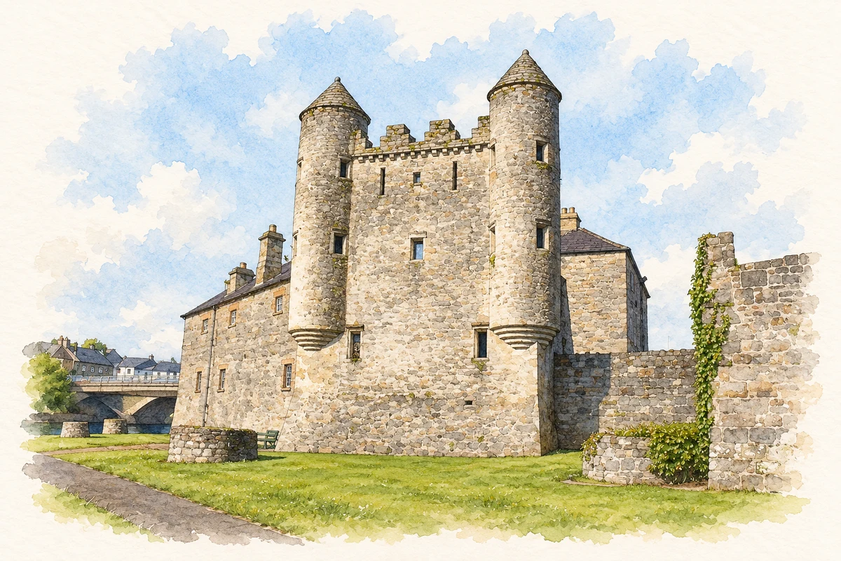
William Cole became constable of Enniskillen Castle in 1609. He enlarged its accommodation and completed the twin-turreted building now called the Watergate by 1614. Its familiar name can mislead: the museum reports that excavation found no evidence that it functioned as a gate to the water, and that nineteenth- and twentieth-century Ordnance Survey maps called it the old castle in ruins. A stone-lined well inside reflects the practical needs of occupation. Cole's building belongs to the Plantation transformation of an earlier Maguire stronghold.[3][4]
A changing riverside
The attractive riverside garden has also served less picturesque purposes. The museum records that this ground was enclosed when the castle became a military barracks in the late eighteenth century. By 1842 a privy block stood at the Watergate's base; from about 1893 the garden area served as a short rifle range, continuing into the 1950s. The present setting therefore contains traces of domestic, military and recreational uses. Reading the towers and green space together gives a fuller history than treating the castle simply as a scenic backdrop.[5]
Both censuses use the same 2015 settlement boundary. These exact counts cover usual residents in the settlement, rather than local government districts or historic counties. Other NISRA tables may use approximate counts.
View population figures
ENNISKILLEN — Settlement 2015 (N11000346) — census population
The report states that these figures use the district as constituted in 1926. This is a historical urban administrative area, separate from the modern settlement boundary and usual-resident population.
View population figures
Enniskillen Urban District — 1926 boundary — census population
The census used a grid rectangle around the built-up area, rather than today’s settlement boundary. The 1981 figures are as enumerated, without adjustment for non-enumeration. These counts remain separate from later settlement totals.
View population figures
Enniskillen — census rectangle H220420 to H260460 — census population
The published 2001 KS01 settlement count uses an earlier geography and disclosure-control methods. It is not rebased to the 2015 settlement used for 2011 and 2021. The geographic matching file can contain a different 2001 count; the figure shown here comes from KS01.
View population figures
Enniskillen — KS01 Settlement (2005 geography) — census population
Enniskillen Castle Watergate illustration: based on a reference photograph by Raymond Millar. AI-assisted watercolour and ink adaptation; warm cream paper margins; incidental modern clutter removed and fine details simplified. Licence: CC BY-SA 2.0.
 placenames