 placenames
Galmoy
Gabhalmhaigh
A round tower and priory ruins preserve medieval building, family commemoration and later religious use near Johnstown.
The name
A reliable full-name meaning has not been established here. The recorded Irish and English forms are given without an unsupported translation.
Recorded forms
- Gabhalmhaigh · Irish · main form · validated name
- Galmoy · English · main form
Place & story
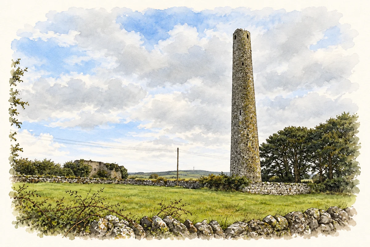
The tower above Grangefertagh
Grangefertagh preserves a limestone round tower, standing 31.5 metres high and formerly divided into eight floors. It belongs to an early medieval monastic site associated with Saint Ciarán of Saigir. The neighbouring priory church also uses limestone. Its fabric includes a two-light window with ogee-shaped heads and evidence of a sacristy entered from the southern side. [2]
A family chapel and carved tomb
The Mac Giolla Phádraig family added a northern chapel in the fifteenth or sixteenth century. Known as the Kilpatrick chapel, it contains a high-relief tomb showing a knight and lady. The inscription names John Mac Giolla Phádraig, his son Brian and Katherine Molloy, Brian’s mother. The Office of Public Works attributes the carving to Rory Tunney, whose work also survives at Jerpoint Abbey. [2]
Later use of a medieval church
After suppression of the priory, Sir Edward Butler held the property, followed by his son in 1567. The church subsequently served Protestant worship from the middle of the sixteenth century until the eighteenth. Its roof collapsed in 1780. These changes in ownership and worship help explain the ruined building beside the tower, where medieval features survived beyond the monastic community’s dissolution. [2]
Geographic information
Sources & further reading
- Logainm.ie — Galmoy. Place names and geographic record, licensed under CC BY 4.0.
- Grangefertagh Round Tower and Church · Office of Public Works / Heritage Ireland
- Grangefertagh round tower, County Kilkenny, as photographed in October 2021 illustration: based on a Round Tower by kevin higgins. AI-assisted watercolour and ink adaptation; cream paper margins added, incidental clutter omitted and fine details simplified. Licence: CC BY-SA 2.0.
Name record retrieved 2026-10-25 · Source record modified 2026-09-19. How this page was prepared.