These Irish name elements are associated with this record in the Logainm glossary.
An element’s translation is a clue, rather than a complete explanation of the name. Its form and meaning depend on local history and the full Irish name.
Recorded forms
An Caisleán Nua· Irish · main form · validated name
Newcastle· English · main form
Place & story
An end-of-line destination
The Belfast and County Down Railway built the Slieve Donard Hotel as a luxury destination at the end of its route. Construction began in 1896 and the hotel opened on 24 June 1898. Its arrival made a substantial architectural statement beside Newcastle’s coast. Railway access and purpose-built accommodation worked together to bring visitors into the seaside town beneath the Mournes.[2]
A hotel with its own infrastructure
The hotel’s early operation required far more than guest rooms. Its own history records a bakery, vegetable gardens, pigs, laundry and generating plant; electricity also supplied the railway station. A siding allowed coal trucks to deliver fuel directly to the building. Coal fires in the bedrooms added to that demand. The resort’s comfortable public rooms depended on an extensive network of food production, fuel and work behind the scenes.[2]
People & connections
James Joseph Farrall’s winning design
Architect James Joseph Farrall won the hotel competition, with Alfred Waterhouse acting as assessor. The architectural archive records collaboration with Young and Mackenzie and Matthew Alexander Robinson as clerk of works. Ruabon brick, Dumfries stone and green tiled and copper roofs gave the building its distinctive materials and silhouette. Numerous competition entrants had proposed alternatives before the chosen design was built.[3]
The coastal path and the Brandy Pad
South of Newcastle, the Bloody Bridge coastal route passes the foundations of St Mary’s medieval church. The local tourism account also connects the mountain track known as the Brandy Pad with smugglers carrying goods inland on small ponies. Spirits, tobacco, sugar and silk figure in that history. The paths join the shore to the mountains as routes of labour and concealed trade as well as recreation.[4]
Both censuses use the same 2015 settlement boundary. These exact counts cover usual residents in the settlement, rather than local government districts or historic counties. Other NISRA tables may use approximate counts.
View population figures
NEWCASTLE — Settlement 2015 (N11000288) — census population
The report states that these figures use the district as constituted in 1926. This is a historical urban administrative area, separate from the modern settlement boundary and usual-resident population.
View population figures
Newcastle Urban District — 1926 boundary — census population
The census used a grid rectangle around the built-up area, rather than today’s settlement boundary. The 1981 figures are as enumerated, without adjustment for non-enumeration. These counts remain separate from later settlement totals.
View population figures
Newcastle — census rectangle J360290 to J390330 — census population
The published 2001 KS01 settlement count uses an earlier geography and disclosure-control methods. It is not rebased to the 2015 settlement used for 2011 and 2021. The geographic matching file can contain a different 2001 count; the figure shown here comes from KS01.
View population figures
Newcastle — KS01 Settlement (2005 geography) — census population
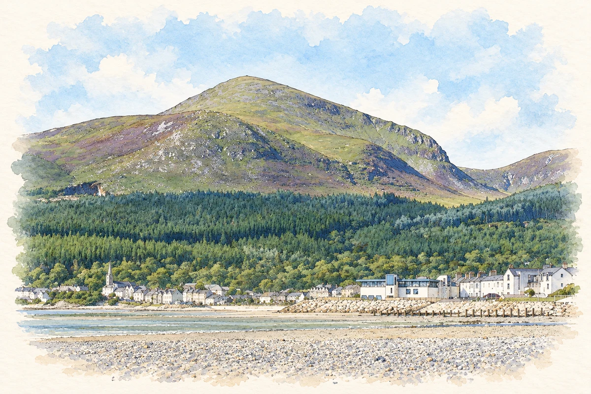
Newcastle beach beneath Slieve Donard illustration: based on a reference photograph by Ivor Anderson (Anderson-Ivor). AI-assisted watercolour and ink adaptation; warm cream paper margins; incidental modern clutter removed and fine details simplified. Licence: CC BY-SA 4.0.
 placenames