These Irish name elements are associated with this record in the Logainm glossary.
An element’s translation is a clue, rather than a complete explanation of the name. Its form and meaning depend on local history and the full Irish name.
Recorded forms
Cill Airne· Irish · main form · validated name
Killarney· English · main form
Place & story
Before the visitor portrait
Lewis’s 1837 entry connects the town’s development with iron smelting, woodland fuel and copper workings at Ross and Muckross. He then attributes much of its contemporary prosperity to the nearby lakes. This is a useful contrast within one dated source: the scenic landscape also supplied raw materials and industrial sites. A history concerned only with visitors would miss work that linked the town to its woods, rivers and mineral resources.[2]
A town receiving strangers
The directory describes inns and lodging houses, reading rooms, lake excursions and small manufactured objects sold to visitors. It also records the influence of the Kenmare estate on streets and approaches. These details reveal a place adapting its public spaces and businesses to people arriving from elsewhere. They do not mean that every person recorded in Killarney was a permanent resident, nor that every local occupation depended on tourism.[2]
Water, work and parish boundaries
Milling on the Deenagh, textile finishing near the Flesk and tanning supported by oak woods appear beside the markets and fairs. Lewis also notes a part of the town extending into Aghadoe parish. His proposed railway is explicitly a proposal in 1837, another reminder to date each feature before treating it as part of the existing transport network.[2]
People & connections
Muckross and a royal visit
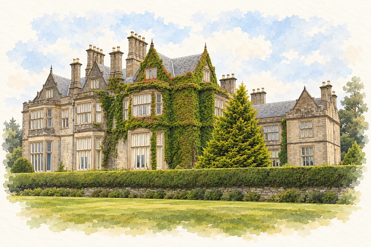
Muckross House, south of the town, was built between 1839 and 1843 for Henry Arthur Herbert and Mary Balfour Herbert, to the design of Scottish architect William Burn. Substantial preparations preceded Queen Victoria's visit in 1861. The house ties the wider Killarney landscape to named patrons, domestic architecture and the staging of an important visit. Its history continued through later owners, including Lord Ardilaun and the Bourn Vincent family.[3]
An estate becomes a public landscape
The Muckross estate formed the nucleus of Killarney National Park when it was presented to the State in 1932. The legal settlement memorialised Maud Bourn Vincent, who had died in 1929, and made provision for maintaining her monument. The National Parks and Wildlife Service identifies the original gift as about 4,300 hectares; later additions included much of the former Kenmare estate. The park's public landscape thus grew from a sequence of gifts and acquisitions. It joins the lakes' scenic history with the history of ownership, commemoration and conservation.[4][5]
Both counts use the 2016 settlement boundary, allowing like-for-like comparison. CSO supplies the 2022 count on this older boundary for comparison only. The official 2022 Built Up Area has different boundaries.
View population figures
Killarney — Census 2016 settlement footprint — census population
These figures use different area definitions. Read the boundary note before comparing them.
Killarney, Kerry — 2011 legal town and environs; 2016 census settlement
Published census settlement populations
14,504people · 2016
Settlement boundaries changed during this period. Differences may reflect boundary changes as well as population change. Where a 2011 legal-town-and-environs count is shown, it has not been recalculated onto the 2016 settlement boundary.
View population figures
Killarney, Kerry — 2011 legal town and environs; 2016 census settlement — census population
Muckross House illustration: based on a reference by Nils E.. AI-assisted watercolour and ink adaptation; clutter removed, cream paper margins added and fine details simplified. Licence: Public domain (PD-self).
 placenames