 placenames
Knockanevin
Cnocán Aoibhinn
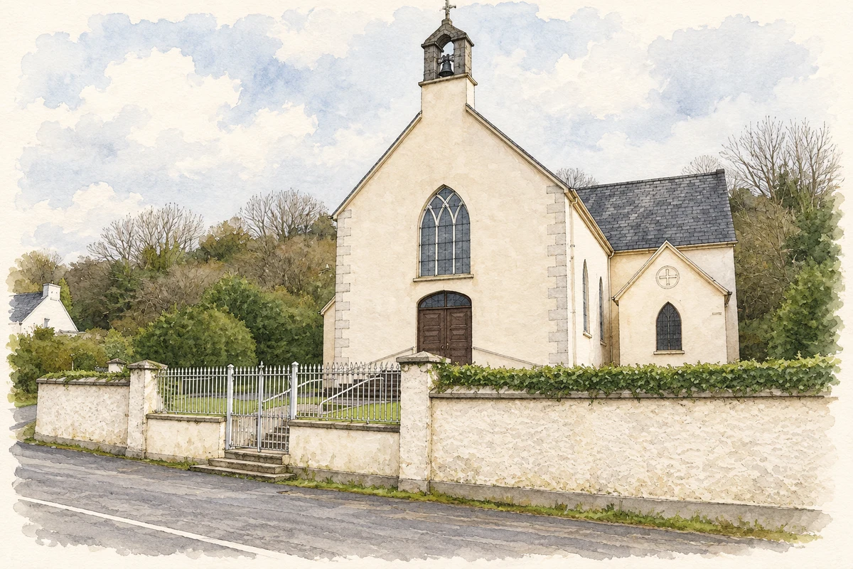
A church beside a road junction forms the settlement’s architectural centre.
The name
These Irish name elements are associated with this record in the Logainm glossary.
An element’s translation is a clue, rather than a complete explanation of the name. Its form and meaning depend on local history and the full Irish name.
Recorded forms
- Cnocán Aoibhinn · Irish · main form · validated name
- Knockanevin · English · main form
Place & story
Saint Molaga’s Church
Saint Molaga’s is a cross-shaped church with pointed windows, later porches on its transepts and an openwork limestone bellcote topped by an iron cross. Stained glass, steps to the entrances, boundary railings and cast-iron gates complete the group recorded by the National Inventory of Architectural Heritage. [2]
A village nucleus
Cork County Council’s 2005 Fermoy plan classified Knockanevin as a village nucleus at the foothills of the Darragh Hills beside the Limerick border. It identified the church as the settlement’s focal point and noted a disused school to its south. [3]
Geographic information
- Place type
- Population centre
- County
- Cork
- Barony
- Condons and Clangibbon
- Civil parish
- Templemolaga
- Within
- Knockanevin
- Coordinates
- 52.29516, -8.38113 (approximate)
- Logainm ID
- 1412883 ↗
Sources & further reading
- Logainm.ie — Knockanevin. Place names and geographic record, licensed under CC BY 4.0.
- Saint Molaga’s Church, NIAH record 20901002 · National Inventory of Architectural Heritage
- Fermoy Electoral Area Local Area Plan 2005, section 26: Knockanevin · Cork County Council
- The church at Knockanevin, as photographed in 2009 illustration: based on a Knockanevin church. by john salter. AI-assisted watercolour and ink adaptation; cream paper margins added, incidental clutter omitted and fine details simplified. Licence: CC BY-SA 2.0.
Name record retrieved 2026-10-25 · Source record modified 2025-01-10. How this page was prepared.