 placenames
Curry
An Choraidh
The Owengarve runs through this Sligo village, where nineteenth-century fair dates and church craftsmanship tell different parts of its story.
The name
These Irish name elements are associated with this record in the Logainm glossary.
An element’s translation is a clue, rather than a complete explanation of the name. Its form and meaning depend on local history and the full Irish name.
Recorded forms
- An Choraidh · Irish · main form · validated name
- Curry · English · main form
Place & story
Three dates in the village calendar
In 1837 Samuel Lewis counted about forty houses and 167 inhabitants at Curry. It stood in Achonry parish on the road towards Swinford and gave its name to the surrounding Catholic district. Its fairs followed both the religious calendar and a fixed summer date: Ascension Day, Corpus Christi and 9 August. These gatherings help explain the village’s role as a meeting place for the surrounding countryside, despite its modest permanent population. [2]
A church altered over time
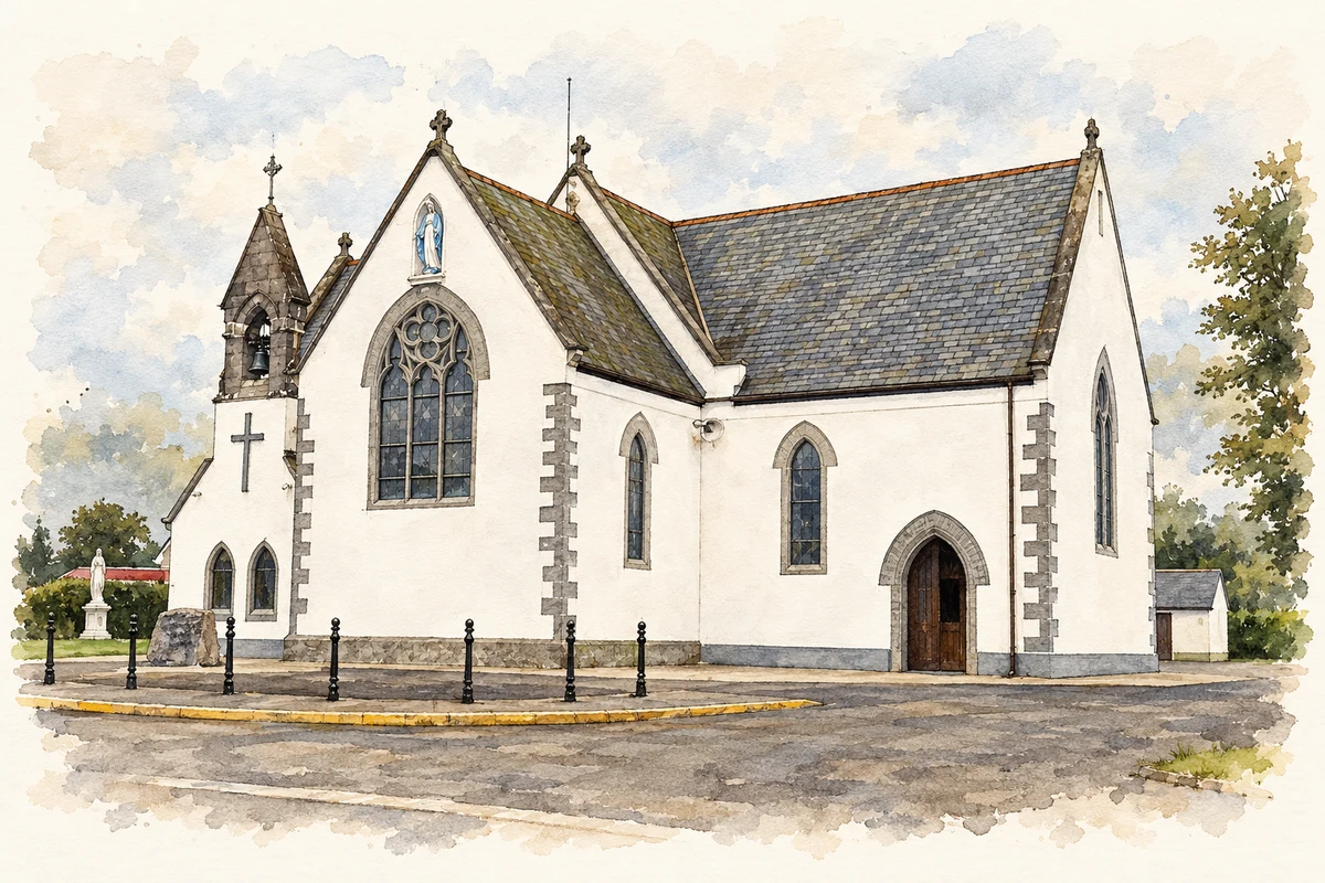
The Church of the Immaculate Conception dates to about 1870 in the National Inventory of Architectural Heritage. The building has a cruciform plan and a small bellcote above the western gable. Its present appearance also records substantial changes around 1970, when render covered the formerly exposed stone walls and new porch and sacristy accommodation were added. Inside, the architectural survey identifies stained glass by Joshua Clark, alongside a panelled chancel ceiling and pointed arches. Those details preserve a distinct nineteenth-century layer within a church adapted to later use. [3]
The river through Curry
The Owengarve River flows through Curry and forms part of the River Moy Special Area of Conservation. The county council’s village plan places the settlement just west of the N17, with the disused Western Rail Corridor running parallel to that road on its eastern side. It also identifies a community centre, playground and health centre, while the GAA ground stands about a kilometre to the north-west. The plan distinguishes the village from the larger statistical areas around it, whose population totals should not be treated as counts of the village itself. [4]
Geographic information
Sources & further reading
- Logainm.ie — Curry. Place names and geographic record, licensed under CC BY 4.0.
- Curry: Samuel Lewis’s 1837 description · Samuel Lewis, reproduced by University of Portsmouth
- Catholic Church of the Immaculate Conception, Curry, record 32319001 · National Inventory of Architectural Heritage
- Chapter 46: Curry Village Plan, Sligo County Development Plan 2024–2030 · Sligo County Council
- Immaculate Conception Church, Curry, County Sligo illustration: based on a Immaculate Conception Church by Anne Burgess. AI-assisted watercolour and ink adaptation; cream paper margins added, incidental clutter omitted and fine details simplified. Licence: CC BY-SA 2.0; adapted illustration distributed under the same licence.
Name record retrieved 2026-10-25 · Source record modified 2025-01-10. How this page was prepared.