 placenames
Finny
Fionnaithe
Finny’s records reveal a small farming community between lake and mountain, with twentieth-century buildings preserving the history of worship and education.
The name
A reliable full-name meaning has not been established here. The recorded Irish and English forms are given without an unsupported translation.
Recorded forms
- Fionnaithe · Irish · main form · validated name
- Finny · English · main form
Place & story
Farming and milling in the nineteenth century
The 1838 Ordnance Survey name-book account describes Finny as mountainous ground combining heath pasture, tillage and small areas of arable land. The village had a chapel and a pound for impounded animals. Griffith's Valuation later recorded tenant farmers including John Lydon, John Walsh and Anthony Joyce. John Philliban occupied a house and corn mill under Joyce. The entries show an economy of farming and small-scale processing within land owned by the Earls of Leitrim and Charlemont. [2]
The Church of the Immaculate Conception
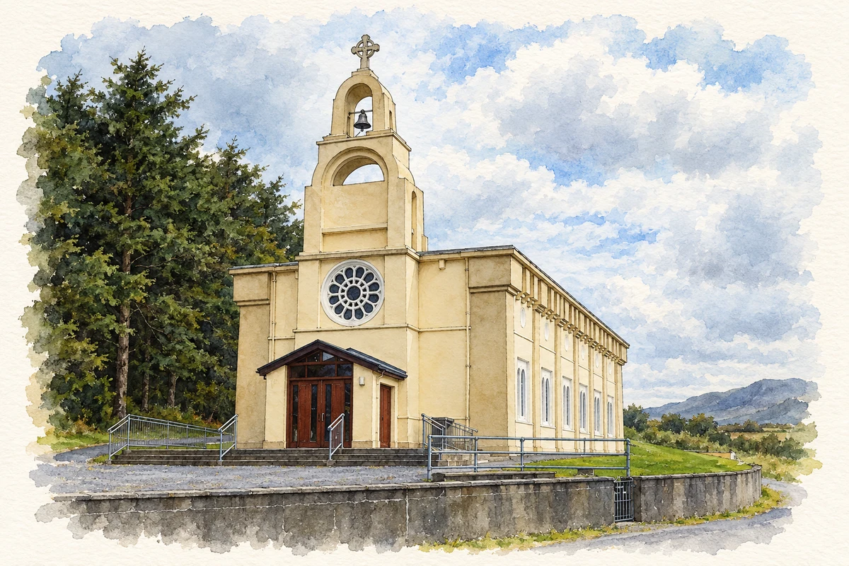
Finny's Church of the Immaculate Conception was built in 1921. Its broad rectangular form, flat roof and tall bellcote give it an unusual outline against Maumtrasna. Paired round-headed windows provide a restrained Romanesque treatment, while a coloured rose window depicts Irish saints. The National Inventory compares its architecture with the contemporary church at Recess. A James P. O'Dea photograph taken in September 1951 records a roof balustrade subsequently lost, providing evidence of how its appearance has changed. [3]
The school above Lough Mask
The former national school stands beside the R300 overlooking Lough Mask. Archaeologist Enda O'Flaherty recorded its single classroom and divided yard in 2017. Although a plaque bears the date 1946, an earlier school appears at the site on the twenty-five-inch Ordnance Survey map. The date therefore should not be treated as proof that schooling began then. His account also notes a former ferry at Bird Hill, recalling the importance of lake crossings when road access was more difficult. [4]
Geographic information
Sources & further reading
- Logainm.ie — Finny. Place names and geographic record, licensed under CC BY 4.0.
- Finny: name books, Griffith’s Valuation and census records · Teresa Philbin, Galway County Heritage Office
- Church of the Immaculate Conception, registration 31312001 · National Inventory of Architectural Heritage
- Finny National School, Finny townland, County Mayo, 17 June 2017 · Enda O’Flaherty, Disused School Houses
- Church of the Immaculate Conception, Finny, County Mayo illustration: based on a Church at Finny by John M. AI-assisted watercolour and ink adaptation; cream paper margins added, incidental clutter omitted and fine details simplified. Licence: CC BY-SA 2.0.
Name record retrieved 2026-10-25 · Source record modified 2016-12-20. How this page was prepared.