These Irish name elements are associated with this record in the Logainm glossary.
An element’s translation is a clue, rather than a complete explanation of the name. Its form and meaning depend on local history and the full Irish name.
Recorded forms
Dún Seachlainn· Irish · main form · validated name
Dunshaughlin· English · main form
Place & story
The town in the directory
Lewis describes Dunshaughlin as a post-town and parish, formerly incorporated, on the road towards Enniskillen. He records about 160 houses and 913 people in the town, within a larger parish population. Fairs in June and December, a dispensary and a constabulary station supported its local role.[2]
A courthouse on Main Street
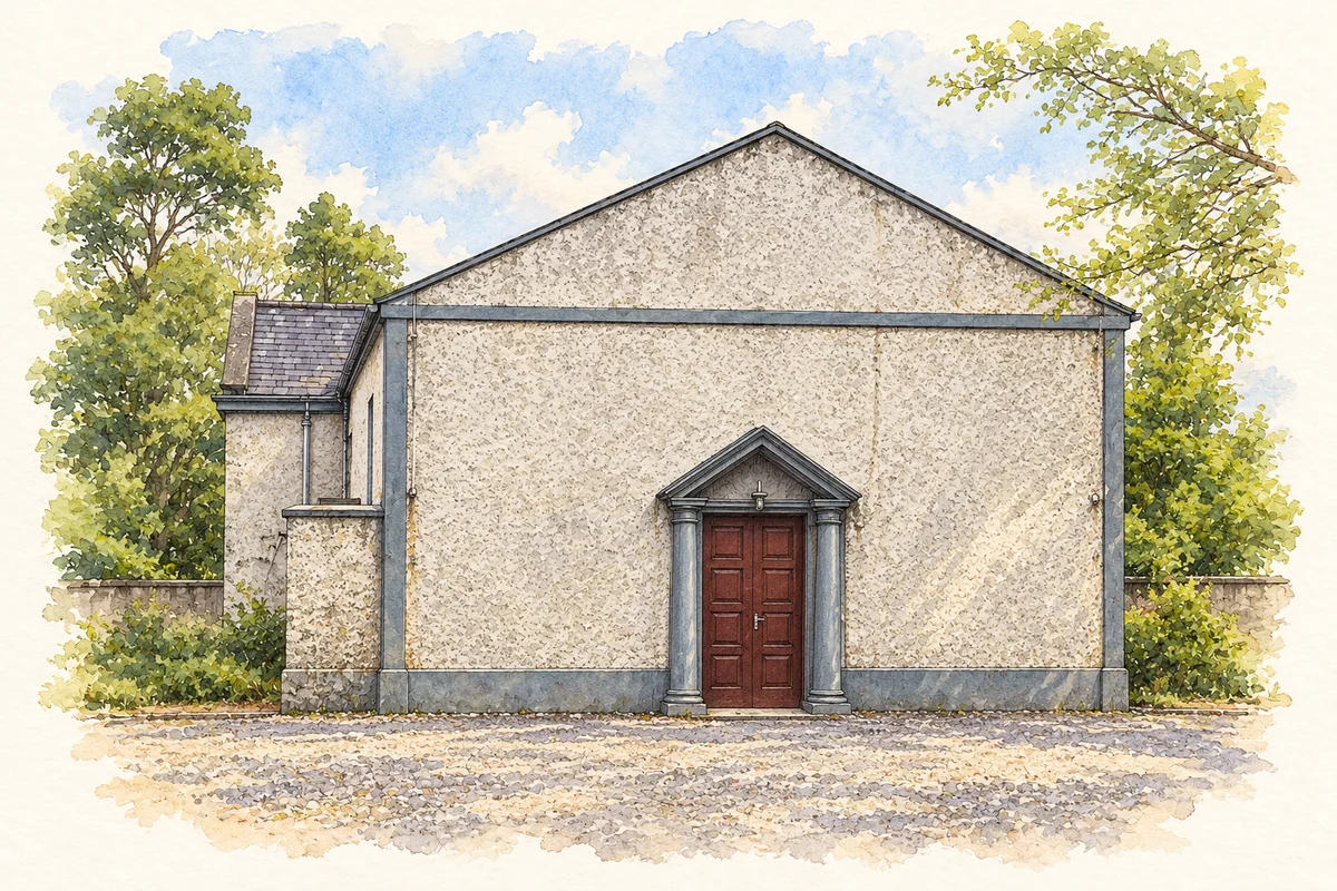
The directory records fortnightly petty sessions and twice-yearly quarter sessions. The surviving courthouse provides a visible connection with that administrative history. NIAH describes a T-plan, gable-fronted building with roughcast walls and a slate roof, attributing its design to Francis Johnston. Its strongest decorative feature is the carved stone doorway, where Tuscan columns support a cornice and pediment. The plain facade is part of its architectural character.[2][3]
Church buildings and changing uses
Another historic landmark is the former Saint Seachnall's Catholic Church, later converted to a public library. NIAH dates its initial building to around 1810 and records substantial Gothic remodelling later in the century. Its stone entrance gable, bellcote and stained glass distinguish it from the courthouse. Together, the two buildings show how civic and religious institutions gave the town enduring landmarks, even as their uses and architectural details changed.[4]
The church and the royal lake settlement
The road town overlays an older ecclesiastical centre associated with Seachnall, or Secundinus, a fifth-century bishop. The archaeological survey records later abbots and raids on the monastery. Nearby Lagore was the seat of the kings of South Brega. Its crannog lay outside the village, while the church enclosure at the northern end of Dunshaughlin shaped the curving road.[5]
Reading several settlement layers
Meath's local plan also identifies a motte in the Catholic graveyard. The early church site, the motte and the later courthouse mark successive layers of settlement along the Main Street.[5][6]
Both counts use the 2016 settlement boundary, allowing like-for-like comparison. CSO supplies the 2022 count on this older boundary for comparison only. The official 2022 Built Up Area has different boundaries.
View population figures
Dunshaughlin — Census 2016 settlement footprint — census population
Dunshaughlin, Meath — Census town, CSO 2006 report
2002–2006: census town
3,384people · 2006
These are the historical areas published in the 2006 census report. Boundaries may differ between censuses and from modern settlements. Legal towns, environs and suburbs are shown separately; none has been combined into a modern settlement total.
View population figures
Dunshaughlin, Meath — Census town, CSO 2006 report — census population
Dunshaughlin, Meath — Census town, CSO 1996 report
1991–1996: census town
2,139people · 1996
These are the historical areas published in the 1996 census report. Boundaries may differ between censuses and from modern settlements. Legal towns, environs and suburbs are shown separately; none has been combined into a modern settlement total.
View population figures
Dunshaughlin, Meath — Census town, CSO 1996 report — census population
Dunshaughlin, Meath — Census town, CSO 1986 report
1981–1986: census town
878people · 1986
Figures cover the historical town area printed in the 1986 report. Boundaries may have changed between censuses. Legal town, environs and suburb totals remain separate and differ from modern settlement boundaries.
View population figures
Dunshaughlin, Meath — Census town, CSO 1986 report — census population
These figures use different area definitions. Read the boundary note before comparing them.
Dunshaughlin, Meath
Published census settlement populations
4,035people · 2016
Settlement boundaries changed during this period. Differences may reflect boundary changes as well as population change. Where a 2011 legal-town-and-environs count is shown, it has not been recalculated onto the 2016 settlement boundary.
Dunshaughlin Courthouse illustration: based on a reference photograph by C O'Flanagan. AI watercolour and ink adaptation; clutter removed, margins added and fine details simplified. Licence: CC BY-SA 2.0.
 placenames