These Irish name elements are associated with this record in the Logainm glossary.
An element’s translation is a clue, rather than a complete explanation of the name. Its form and meaning depend on local history and the full Irish name.
Recorded forms
Bealach an Doirín· Irish · main form · validated name
Ballaghaderreen· English · main form
Place & story
People & connections
John Blake Dillon and The Nation
John Blake Dillon was born in Ballaghaderreen in 1814. After studying at Maynooth and Trinity College Dublin, he became a barrister and formed an important friendship with Thomas Davis. Dillon, Davis and Charles Gavan Duffy founded The Nation newspaper in 1842, a central publication of the Young Ireland movement. Dillon later took part in the events surrounding the unsuccessful 1848 rising and escaped to the United States. His birthplace gives the town a direct connection with the journalism and political debates of that generation.[2]
A cathedral built in stages
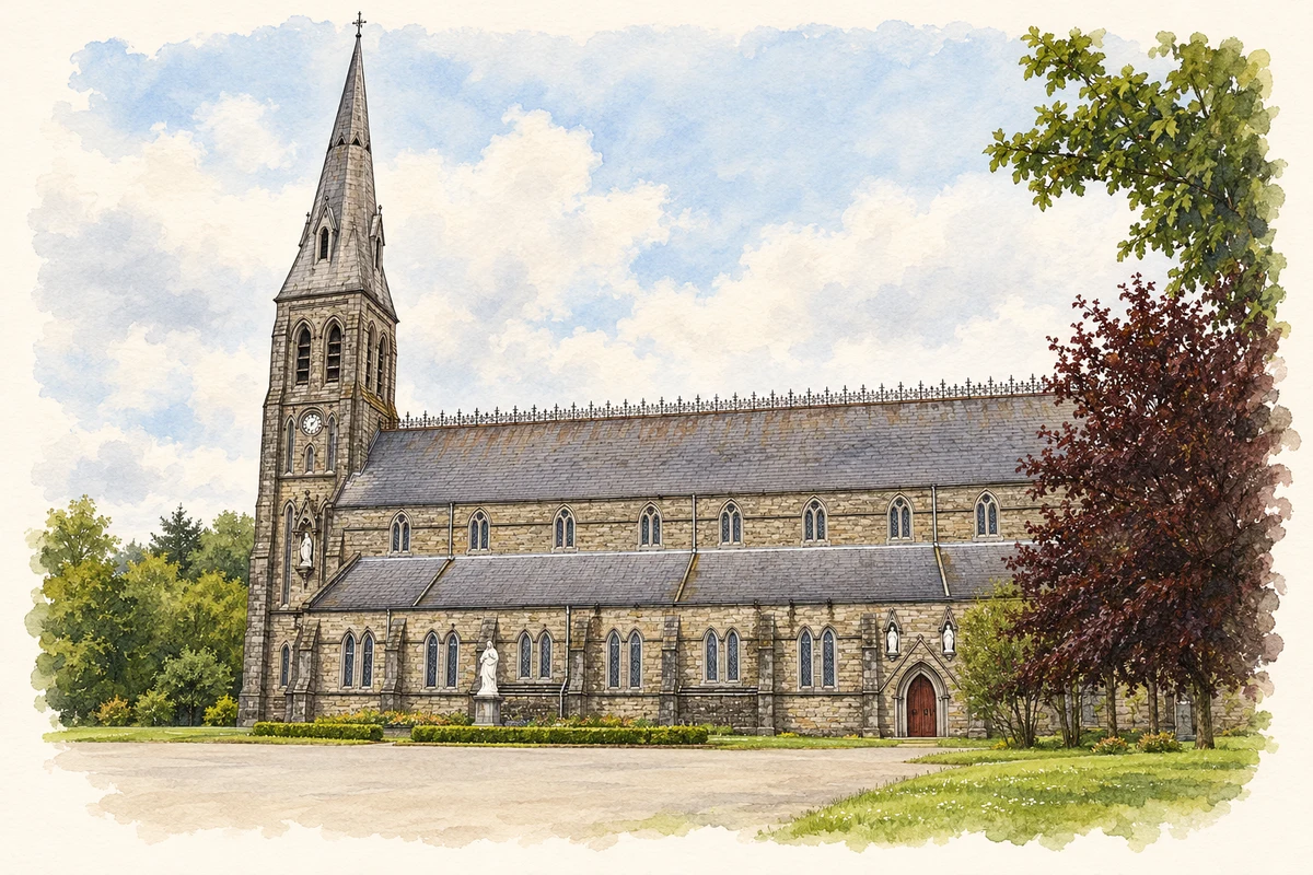
The Cathedral of the Annunciation and Saint Nathy belongs principally to the mid-nineteenth century, with construction recorded in the National Inventory of Architectural Heritage from 1855. Its sandstone walls, limestone dressings, nave and aisles form a substantial Gothic building. The tower's spire, additional sacristy and bells date to work in 1912, associated with W. H. Byrne. The building's familiar outline therefore combines successive campaigns rather than a single finished design. Those later additions are important when comparing old photographs with the skyline seen today.[3]
The town’s own power station
A small stone building on Chapel Street preserves another part of Ballaghaderreen's development. Built in 1908 as a power station, it originally used two suction-gas engines. In 1913 the local lighting committee sought a loan to adapt the system to hydroelectric power from the Luny River. The National Inventory traces these stages through contemporary engineering publications and newspaper notices. After decommissioning in 1933, the building served other purposes, including a science laboratory for Saint Nathy's College and later a museum and arts centre.[4]
Ballaghaderreen — Census 2016 settlement footprint
Population within 2016 settlement boundaries
2,339people · 2022
Both counts use the 2016 settlement boundary, allowing like-for-like comparison. CSO supplies the 2022 count on this older boundary for comparison only. The official 2022 Built Up Area has different boundaries.
View population figures
Ballaghaderreen — Census 2016 settlement footprint — census population
Ballaghaderreen, Roscommon — Census town, CSO 2006 report
2002–2006: census town
1,720people · 2006
These are the historical areas published in the 2006 census report. Boundaries may differ between censuses and from modern settlements. Legal towns, environs and suburbs are shown separately; none has been combined into a modern settlement total.
View population figures
Ballaghaderreen, Roscommon — Census town, CSO 2006 report — census population
Ballaghaderreen, Roscommon — Census town, CSO 1996 report
1991–1996: census town
1,248people · 1996
These are the historical areas published in the 1996 census report. Boundaries may differ between censuses and from modern settlements. Legal towns, environs and suburbs are shown separately; none has been combined into a modern settlement total.
View population figures
Ballaghaderreen, Roscommon — Census town, CSO 1996 report — census population
Ballaghaderreen, Roscommon — Census town, CSO 1986 report
1981–1986: census town
1,366people · 1986
Figures cover the historical town area printed in the 1986 report. Boundaries may have changed between censuses. Legal town, environs and suburb totals remain separate and differ from modern settlement boundaries.
View population figures
Ballaghaderreen, Roscommon — Census town, CSO 1986 report — census population
These figures use different area definitions. Read the boundary note before comparing them.
Ballaghaderreen, Roscommon
Published census settlement populations
1,808people · 2016
Settlement boundaries changed during this period. Differences may reflect boundary changes as well as population change. Where a 2011 legal-town-and-environs count is shown, it has not been recalculated onto the 2016 settlement boundary.
Ballaghaderreen Cathedral, County Roscommon illustration: based on a BallaghaderreenCathedral by JohnArmagh. AI-assisted watercolour and ink adaptation; cream paper margins added, incidental clutter omitted and fine details simplified. Licence: CC BY-SA 3.0.
 placenames