These Irish name elements are associated with this record in the Logainm glossary.
An element’s translation is a clue, rather than a complete explanation of the name. Its form and meaning depend on local history and the full Irish name.
Recorded forms
An Chorr Chríochach· Irish · main form · validated name
Cookstown· English · main form
Place & story
People & connections
William Stewart's street
William Stewart laid out Cookstown’s long main street around 1750. The historic gardens register places this work within the Stewart family’s ownership of the surrounding land, which began in the seventeenth century. The planned town and Killymoon demesne developed through related acts of patronage.[2]
John Nash at Killymoon
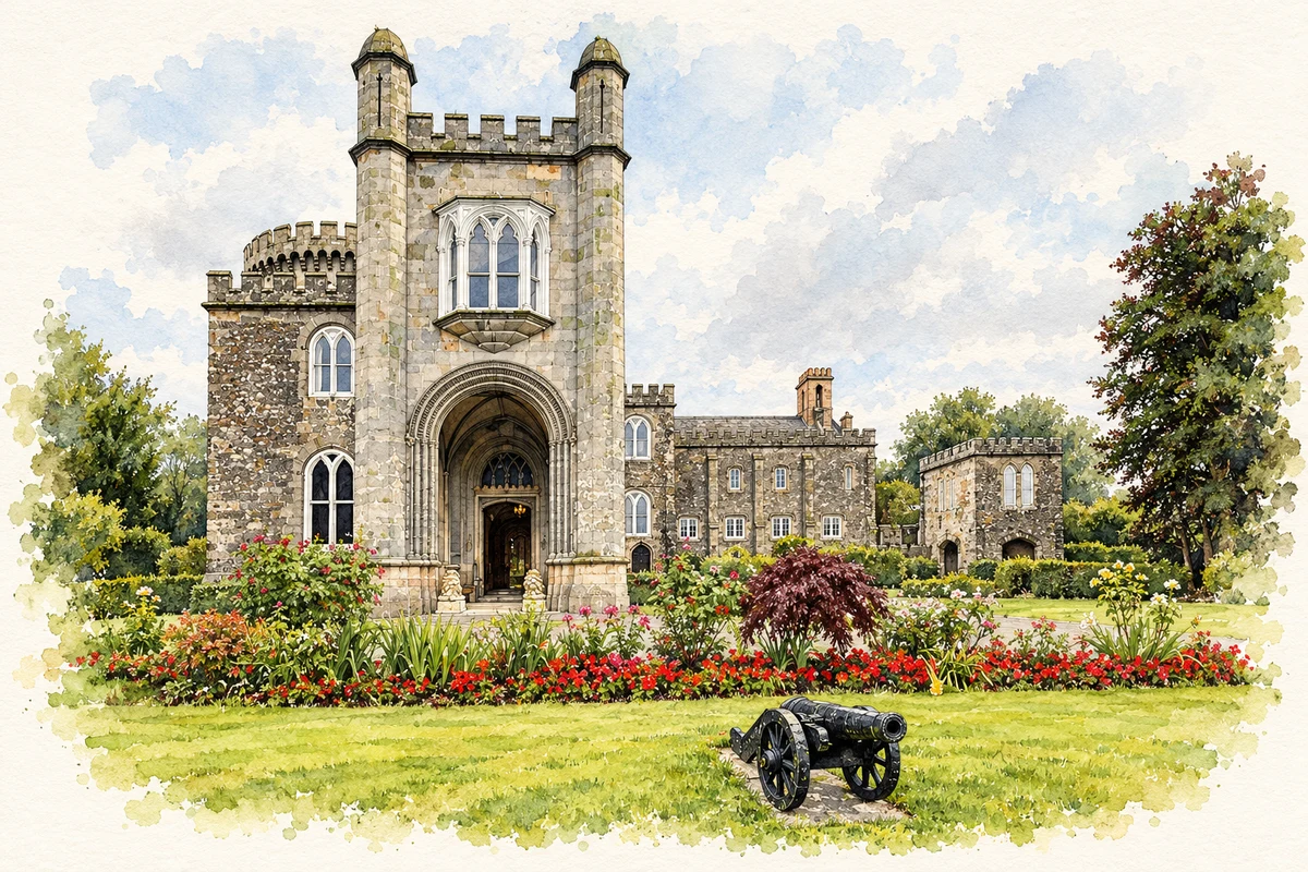
Killymoon Castle was designed for the Stewart family by John Nash in the early nineteenth century. An 1841 Irish Penny Journal account describes its deliberately varied towers: a large circular tower, an octagonal one and a square tower, with a chapel-like library adjoining. Its picturesque appearance was therefore composed from contrasting forms. The building is a country house near Cookstown, not an intact medieval fortress, despite the castle name and defensive-looking details.[3]
A disputed fire story
Accounts differ over what prompted Killymoon’s rebuilding. The 1841 Irish Penny Journal repeats a story of fire at the earlier house. The historic gardens register notes that family correspondence does not mention the commonly cited 1799 fire, and suggests that William Stewart’s death in 1797 and his son’s succession may explain the change.[2][3]
People & connections
A landscape beyond the house
A straight avenue, tree-lined vistas and possible traces of an enclosed garden preserve earlier formal planning within the demesne. William Stewart also provided a Presbyterian meetinghouse. Nash’s country house occupied a landscape already shaped by previous generations of estate owners.[2]
Both censuses use the same 2015 settlement boundary. These exact counts cover usual residents in the settlement, rather than local government districts or historic counties. Other NISRA tables may use approximate counts.
View population figures
COOKSTOWN — Settlement 2015 (N11000193) — census population
The report states that these figures use the district as constituted in 1926. This is a historical urban administrative area, separate from the modern settlement boundary and usual-resident population.
View population figures
Cookstown Urban District — 1926 boundary — census population
The census used a grid rectangle around the built-up area, rather than today’s settlement boundary. The 1981 figures are as enumerated, without adjustment for non-enumeration. These counts remain separate from later settlement totals.
View population figures
Cookstown — census rectangle H790760 to H820800 — census population
The published 2001 KS01 settlement count uses an earlier geography and disclosure-control methods. It is not rebased to the 2015 settlement used for 2011 and 2021. The geographic matching file can contain a different 2001 count; the figure shown here comes from KS01.
View population figures
Cookstown — KS01 Settlement (2005 geography) — census population
Killymoon Castle illustration: based on a reference photograph by Kenneth Allen. AI-assisted watercolour and fine ink adaptation; warm cream paper margins; incidental clutter removed and architectural details simplified. Licence: CC BY-SA 2.0.
 placenames