A reliable full-name meaning has not been established here. The recorded Irish and English forms are given without an unsupported translation.
Recorded forms
Lusca· Irish · main form · validated name
Lusk· English · main form
Place & story
A layered church site
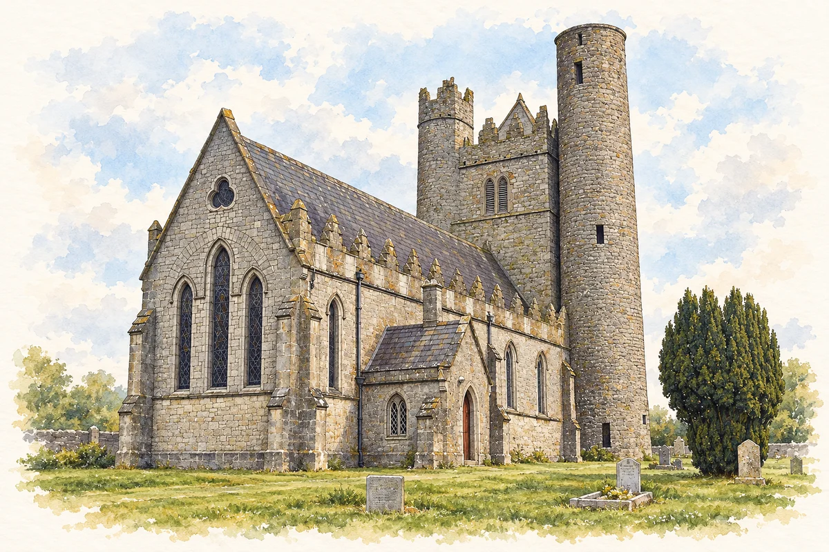
Lewis’s 1837 entry presents Lusk as an important ecclesiastical settlement, recording traditions associated with Macculind and a succession of destructive raids and fires. The surviving tower and church complex offers a more immediate architectural connection, though its different parts should not be treated as one building of a single date.[2]
A monument within a monument
The directory describes a square battlemented tower with circular corner towers, one markedly larger than the others. Inside the church it records elaborate funerary sculpture, including the monument to Christopher Barnewall and his wife. Together, these details point to successive forms of patronage and remembrance. The monuments preserve the names of prominent families, while the surrounding burial ground also belongs to the less conspicuous history of the community.[2]
A round tower hidden in plain sight
Fingal's architectural account identifies a ninth-century round tower incorporated into a later belfry, with a nineteenth-century church adjoining it. The round tower stands about twenty-seven metres high. Raised ground levels have brought its doorway to less than a metre above the surrounding surface, while the nine internal floors, including the basement, were added in the nineteenth century. Those alterations explain why the present appearance cannot be read straightforwardly as the original medieval arrangement. The complex is an unusually visible lesson in buildings being reused.[3]
People & connections
A teacher at Corduff
Thomas Ashe's local connection was his teaching work: born in Kerry, he became principal of Corduff National School near Lusk in 1908. He supported Irish-language and cultural activity, founded the Black Raven Pipe Band and Round Towers GAA club, and commanded the Fingal battalion during Easter Week 1916. Released from prison in June 1917, he was arrested again that August. He died after forced feeding during a hunger strike in September. His story connects the district's schools and voluntary associations with the wider revolutionary period, without describing him as Lusk-born.[4][5]
Both counts use the 2016 settlement boundary, allowing like-for-like comparison. CSO supplies the 2022 count on this older boundary for comparison only. The official 2022 Built Up Area has different boundaries.
View population figures
Lusk — Census 2016 settlement footprint — census population
These figures use different area definitions. Read the boundary note before comparing them.
Lusk, Fingal
Published census settlement populations
7,786people · 2016
Settlement boundaries changed during this period. Differences may reflect boundary changes as well as population change. Where a 2011 legal-town-and-environs count is shown, it has not been recalculated onto the 2016 settlement boundary.
Lusk church, belfry and round tower illustration: based on a reference by Kieran Campbell. AI-assisted watercolour/ink adaptation; clutter removed, paper margins added and fine details simplified. Licence: CC BY-SA 2.0.
 placenames