 placenames
Tallaght
Tamhlacht
Tallaght’s modern centre grew around a much older village, whose churches preserve the memory of monastic learning and later religious communities.
The name
A reliable full-name meaning has not been established here. The recorded Irish and English forms are given without an unsupported translation.
Recorded forms
- Tamhlacht · Irish · main form · validated name
- Tallaght · English · main form
Place & story
Maelruain’s monastery and the surviving tower
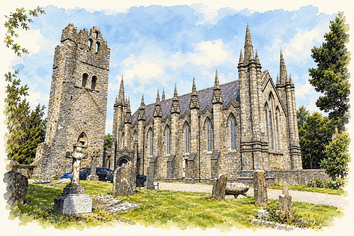
Tallaght’s monastery was founded by Maelruain in 769 and became associated with the Céli Dé reform movement. Its site is occupied by Saint Maelruain’s Church of Ireland, built in 1829 beside an older tower. The tower’s spiral stair and stone-vaulted upper floor distinguish it from the later church. A shallow granite font, locally called Maelruain’s Losset, and an ancient cross remain in the churchyard, linking the present enclosure with its earlier religious history. [2]
Parthalon’s plague: a legendary explanation
The story of Parthalon explains Tallaght’s burial-place name through a plague said to have killed his followers. South Dublin County Council’s history records this annalistic tradition but also stresses the archaeological limit: excavated prehistoric burials in the area have not established the legendary mass grave. [2]
The Dominican house of studies
The Dominicans established Saint Mary’s Priory in Tallaght in 1855, making it the Irish province’s house of studies. Its teaching role developed into an open Studium Generale in 1935, followed by affiliation with Rome’s Angelicum in 1971. In 1972, the friars also assumed responsibility for the local parish as Tallaght’s population expanded, helping develop churches and schools for the growing community. The priory’s history thus joins a long tradition of theological education with the practical demands of a rapidly changing town. [3]
From rural village to county headquarters
Dublin County Council’s 1960s plans for a new town transformed Tallaght’s setting. Major additions in the 1990s included the Square shopping centre, hospital and third-level college. South Dublin County Council established its headquarters here in 1994. The old village remained within a greatly enlarged urban settlement, rather than disappearing beneath it. [2]
Geographic information
- Place type
- Town
- County
- Dublin
- Barony
- Uppercross
- Civil parish
- Tallaght
- Coordinates
- 53.28233, -6.38055 (approximate)
- Logainm ID
- 17457 ↗
Sources & further reading
- Logainm.ie — Tallaght. Place names and geographic record, licensed under CC BY 4.0.
- History of Tallaght · South Dublin County Council
- Tallaght: Saint Mary’s community and history · Dominican Friars Ireland
- Saint Maelruain's Church and medieval tower, Tallaght illustration: based on a St. Maelruain's Church, Tallaght - 2025-07-12 01 by 瑞丽江的河水. AI-assisted watercolour and ink adaptation; cream paper margins added, incidental clutter omitted and fine details simplified. Licence: CC BY-SA 4.0.

Name record retrieved 2026-10-25 · Source record modified 2026-09-19. How this page was prepared.