 placenames
Annaghmore
Eanach Mór
Annaghmore’s nineteenth-century church and former railway station record two different connections between this rural Armagh community and the wider world.
The name
These Irish name elements are associated with this record in the Logainm glossary.
An element’s translation is a clue, rather than a complete explanation of the name. Its form and meaning depend on local history and the full Irish name.
Recorded forms
- Eanach Mór · Irish · main form · validated name
- Annaghmore · English · main form
Place & story
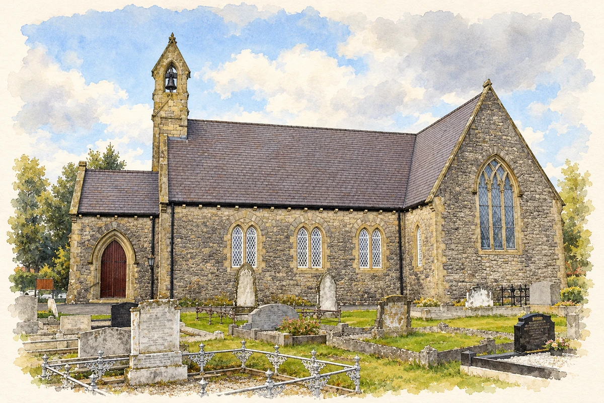
Building Saint Francis’s
Saint Francis's Church of Ireland was designed during the 1850s and opened on 7 June 1856. Richard Cherry of Loughgall was the builder. Consecration followed in July 1861, so the opening and dedication belong to different stages in its history. The official historic-building survey identifies a Gothic Revival church with nave, chancel, transepts and a western porch, constructed in limestone with sandstone dressings. [2]
Craftsmen and later additions
The church's fittings bring several named makers into Annaghmore's story. Thomas Hodges of Abbey Street, Dublin, cast its bell in 1856. An organ by Telford and Telford arrived from another parish around 1888–1890. The east window followed in 1898 and a stone pulpit in 1906. These additions show the congregation furnishing and adapting its church over half a century after the original building campaign. [2]
Fruit traffic on the Derry Road
Annaghmore station served the Portadown and Dungannon railway, opened in April 1858. Local historian W. E. C. Fleming records substantial fruit consignments passing through the station, with a special store erected around 1930. The railway linked the orchard district with outside markets as well as carrying passengers. After a wartime revival, the line closed in February 1965. Its history places agricultural commerce alongside the church in the community's nineteenth- and twentieth-century development. [3]
Geographic information
- Place type
- Population centre
- County
- Armagh
- Barony
- Oneilland West
- Civil parish
- Loughgall
- Coordinates
- 54.46207, -6.58110 (approximate)
- Logainm ID
- 56526 ↗
Sources & further reading
- Logainm.ie — Annaghmore. Place names and geographic record, licensed under CC BY 4.0.
- Saint Francis’s Church, Annaghmore, HB15/02/055 · Department for Communities, Historic Environment Division
- Communications in Clancan, Review volume 5 number 3 (1987) · W. E. C. Fleming, Craigavon Historical Society
- Saint Francis Church, Annaghmore, County Armagh illustration: based on a Annaghmore Parish Church by Raymond Okonski. AI-assisted watercolour and ink adaptation; cream paper margins added, incidental clutter omitted and fine details simplified. Licence: CC BY-SA 2.0. Additional reference: Annaghmore Parish Church by Raymond Okonski, CC BY-SA 2.0.
Name record retrieved 2026-10-25 · Source record modified 2021-12-20. How this page was prepared.