The May Fair made Ballyclare a meeting place for traders and workers, while the Market Square hall developed from a commercial building into a civic venue.
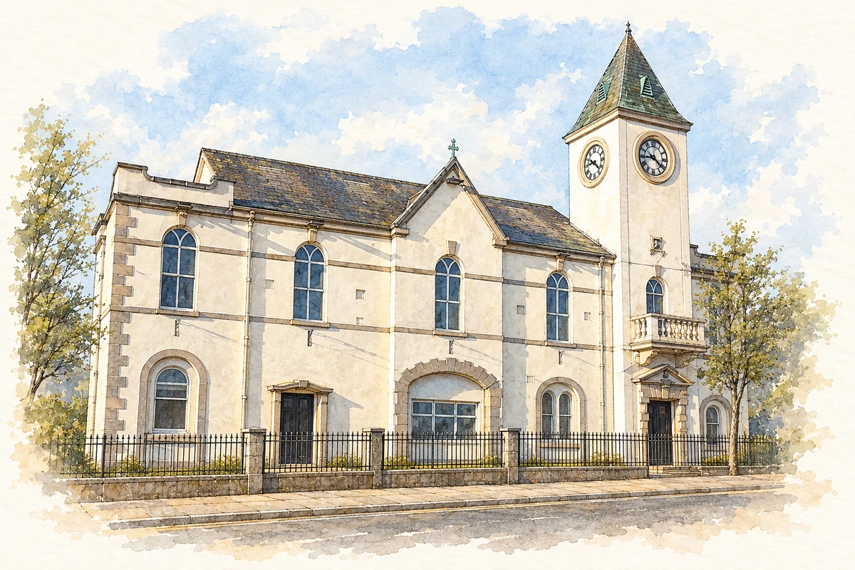
Illustration, Ballyclare Town Hall
⊕Recorded locationBallyclare54.75032° N · 5.99628° WInteractive map supplied by OpenStreetMap.
These Irish name elements are associated with this record in the Logainm glossary.
An element’s translation is a clue, rather than a complete explanation of the name. Its form and meaning depend on local history and the full Irish name.
Recorded forms
Bealach Cláir· Irish · main form · validated name
Ballyclare· English · main form
Place & story
A chartered gathering
A royal charter of 16 December 1756 granted the Earl of Donegall two annual fairs at Ballyclare, subject to a payment to the Crown. Archie R. Reid’s history, reproduced by Ballyclare Historical Society, records later fairs in four months, with May and November especially important for the surrounding countryside.[3]
Horses and hiring
At the May and November fairs, farmers hired labourers and servant girls for six-month terms. Horse trading grew so substantial that sales occupied the Monday before the traditional Tuesday May Fair. Dealers brought strings of animals, and cavalry regiments sent buyers. Employment and livestock bargaining shared the town’s public gathering place.[3]
The hall in Market Square
The official listed-building record identifies the Town Hall as a rendered, two-storey building constructed in 1877, with later additions. Its projecting entrance tower, slate roof, stucco quoins and round-headed openings give it a conspicuous position in the square. The record traces earlier market-house uses through maps and valuations. It stands within the town’s historic commercial centre.[2]
A place for public life
The Town Hall’s upper hall and supporting rooms developed through successive alterations. Its facade and internal accommodation served the growing civic use of a building within the historic commercial centre. The open square and the hall provided complementary spaces for bringing the district together.[2]
Both censuses use the same 2015 settlement boundary. These exact counts cover usual residents in the settlement, rather than local government districts or historic counties. Other NISRA tables may use approximate counts.
View population figures
BALLYCLARE — Settlement 2015 (N11000546) — census population
Ballyclare Town Hall illustration: based on a reference by Deardickens. AI-assisted watercolour and ink adaptation; warm cream paper margins; incidental modern clutter removed and fine details simplified. Licence: CC BY-SA 4.0.
 placenames