 placenames
Ardfert
Ard Fhearta
The wider parish’s history reaches from Barrow’s creek to schools that served Ardfert, Banna and Tubrid.
The name
These Irish name elements are associated with this record in the Logainm glossary.
An element’s translation is a clue, rather than a complete explanation of the name. Its form and meaning depend on local history and the full Irish name.
Recorded forms
- Ard Fhearta · Irish · main form
- Ardfert · English · main form
Place & story
Farmland and a difficult harbour
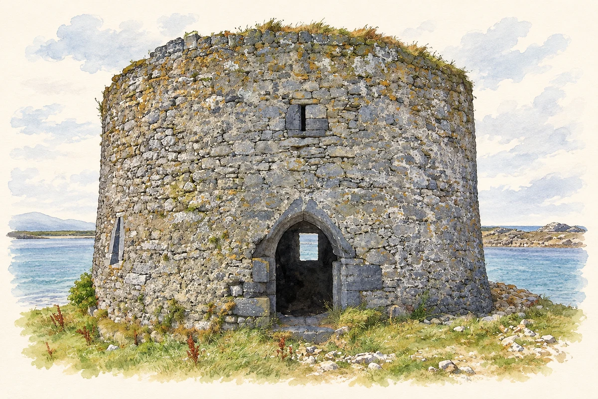
Ardfert parish included extensive pasture farms and smaller tillage holdings, with sandhills, marsh and bog beyond the acreage assessed for tithes. Lewis’s 1837 description also places Barrow’s creek within the parish. The Fishery Board had built a pier there, but he judged its position ineffective. Castles guarded the entrance and stood farther inside towards Fenit. This coastal setting formed another part of Ardfert’s landscape beyond its better-known cathedral precinct. [2]
Two free schools before the Famine
Lewis recorded two free schools with different patrons. Mrs Crosbie had built a thatched stone schoolhouse, supported jointly by her and the cathedral dignitaries. Around forty-five children attended, although the building could accommodate many more. Near the Catholic chapel, parish priest J. O’Sullivan had erected and chiefly supported another school, teaching about 150 boys and ninety girls. The account ties education to local benefactors as well as religious institutions. [2]
Three schools join in 1974
Ardfert Central National School opened on 26 August 1974. Its own history records the amalgamation of the earlier Ardfert, Banna and Tubrid schools. The new institution therefore brought together children from several established school communities in the surrounding district. [3]
A chain across the creek
Lewis recorded a tradition that a chain once stretched from the castle at Barrow’s harbour entrance to the opposite rock, preventing hostile vessels from entering suddenly. His wording identifies a traditional explanation of the castle’s defensive role. It records the story’s existence by 1837, rather than supplying archaeological proof of the chain. [2]
Geographic information
- Place type
- Civil parish
- County
- Kerry
- Barony
- Trughanacmy
- Barony
- Clanmaurice
- Coordinates
- 52.32588, -9.79038 (approximate)
- Mapped area
- 39.95 km²
- Logainm ID
- 1050 ↗
Sources & further reading
- Logainm.ie — Ardfert. Place names and geographic record, licensed under CC BY 4.0.
- Ardfert diocese and parish, A Topographical Dictionary of Ireland 1837 · Samuel Lewis
- Ardfert Central National School: school history · Ardfert Central National School
- The surviving round castle at Barrow harbour entrance, County Kerry, as photographed in September 2014 illustration: based on a Castles of Munster: Barrow, Kerry (1) by Garry Dickinson. AI-assisted watercolour and ink adaptation; cream paper margins added, incidental clutter omitted and fine details simplified. Licence: CC BY-SA 2.0.
Name record retrieved 2026-10-25 · Source record modified 2025-05-28. How this page was prepared.