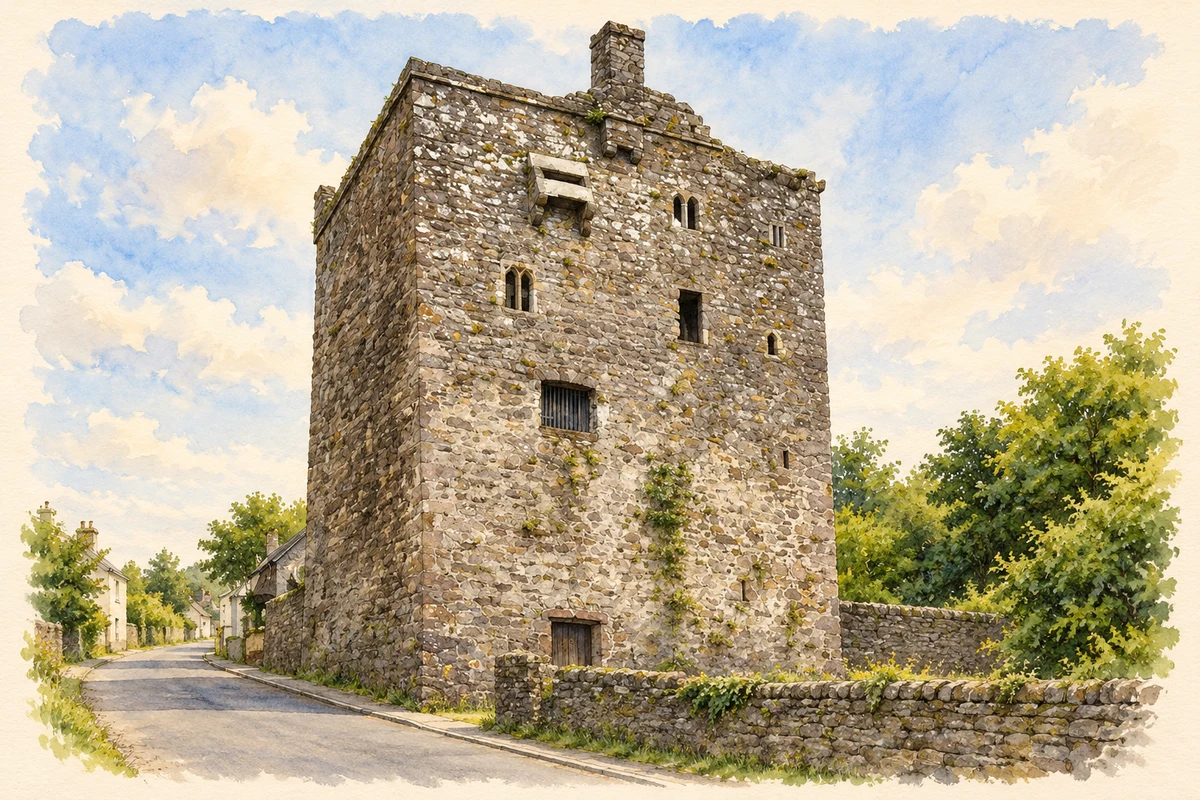
Ballyhack's intact medieval tower overlooks an estuary settlement whose records include fishing, customs disputes and the dangerous work of lowering millstones to the quay.
Illustration, Ballyhack Castle
⊕Recorded locationBallyhack52.24914° N · 6.96420° WInteractive map supplied by OpenStreetMap.
These Irish name elements are associated with this record in the Logainm glossary.
An element’s translation is a clue, rather than a complete explanation of the name. Its form and meaning depend on local history and the full Irish name.
Recorded forms
Baile Hac· Irish · main form
Ballyhack· English · main form
Place & story
Five storeys above the estuary
Ballyhack Castle stands on a steep slope overlooking Waterford Estuary. The Office of Public Works dates it to around 1450 and attributes its construction to the Knights Hospitaller of St John. The tower rises five storeys, with walls surviving to the wall-walk. A small chapel is built into the second-floor wall and retains an altar, a piscina and an aumbry. Defensive features include a machicolation outside the entrance and a murder hole within. The combination of chapel and protected doorway preserves both devotional and defensive functions in one compact building.[2]
Shipping, fish and the Waterford market
Samuel Lewis recorded 258 inhabitants at Ballyhack in 1837. Shipping anchored in the estuary helped support the village, and vessels could also lie beside its quay. Fishing was important, while corn and pigs were traded for the Waterford market. Lewis noted that nearby Arthurstown's growth had drawn population away from Ballyhack. His account therefore shows a working harbour settlement whose fortunes were affected both by estuary traffic and by competition from a neighbouring village in the same parish.[3]
People & connections
William Ilger and the customs duties
Local maritime historian Andrew Doherty's research identifies William Ilger as a Ballyhack merchant fined in 1395 for selling goods at New Ross without paying customs. The goods included salt, iron, hides and cloth. Later records include the appointment of a gauger and searcher for Ross, Ballyhack and Duncannon in 1542, and the seizure of a ship carrying untaxed wool in 1550. These entries place Ballyhack within a regulated commercial network, where merchants, ships and officials disputed the dues attached to moving goods through the harbour.[4]
Millstones lowered down the rock
Robert Leigh's 1684 description, quoted in Doherty's archival study, records an old quay beneath a steep rock at Ballyhack and passengers crossing to Passage in Munster. He also described millstones being worked from the rock above the village. Workers lowered them down the precipice to the quay, where they could be shipped onwards. This distinctive piece of evidence adds quarrying and heavy stone transport to the village's fishing and ferry history, showing how the steep coastal setting shaped local work.[4]
Both counts use the 2016 settlement boundary, allowing like-for-like comparison. CSO supplies the 2022 count on this older boundary for comparison only. The official 2022 Built Up Area has different boundaries.
View population figures
Ballyhack — Census 2016 settlement footprint — census population
These are the historical areas published in the 2006 census report. Boundaries may differ between censuses and from modern settlements. Legal towns, environs and suburbs are shown separately; none has been combined into a modern settlement total.
View population figures
Ballyhack, Wexford — Census town, CSO 2006 report — census population
These are the historical areas published in the 1996 census report. Boundaries may differ between censuses and from modern settlements. Legal towns, environs and suburbs are shown separately; none has been combined into a modern settlement total.
View population figures
Ballyhack, Wexford — Census town, CSO 1996 report — census population
Figures cover the historical town area printed in the 1986 report. Boundaries may have changed between censuses. Legal town, environs and suburb totals remain separate and differ from modern settlement boundaries.
View population figures
Ballyhack, Wexford — Census town, CSO 1986 report — census population
These figures use different area definitions. Read the boundary note before comparing them.
Ballyhack, Wexford
Published census settlement populations
206people · 2016
Settlement boundaries changed during this period. Differences may reflect boundary changes as well as population change. Where a 2011 legal-town-and-environs count is shown, it has not been recalculated onto the 2016 settlement boundary.
 placenames