 placenames
Bridgetown
Baile an Droichid
Buildings and excavated features at Mulrankin reveal medieval occupation and later domestic alterations within the wider district.
The name
These Irish name elements are associated with this record in the Logainm glossary.
An element’s translation is a clue, rather than a complete explanation of the name. Its form and meaning depend on local history and the full Irish name.
Recorded forms
- Baile an Droichid · Irish · main form · non-validated name
- Bridgetown · English · main form
Place & story
A farmhouse beside the castle
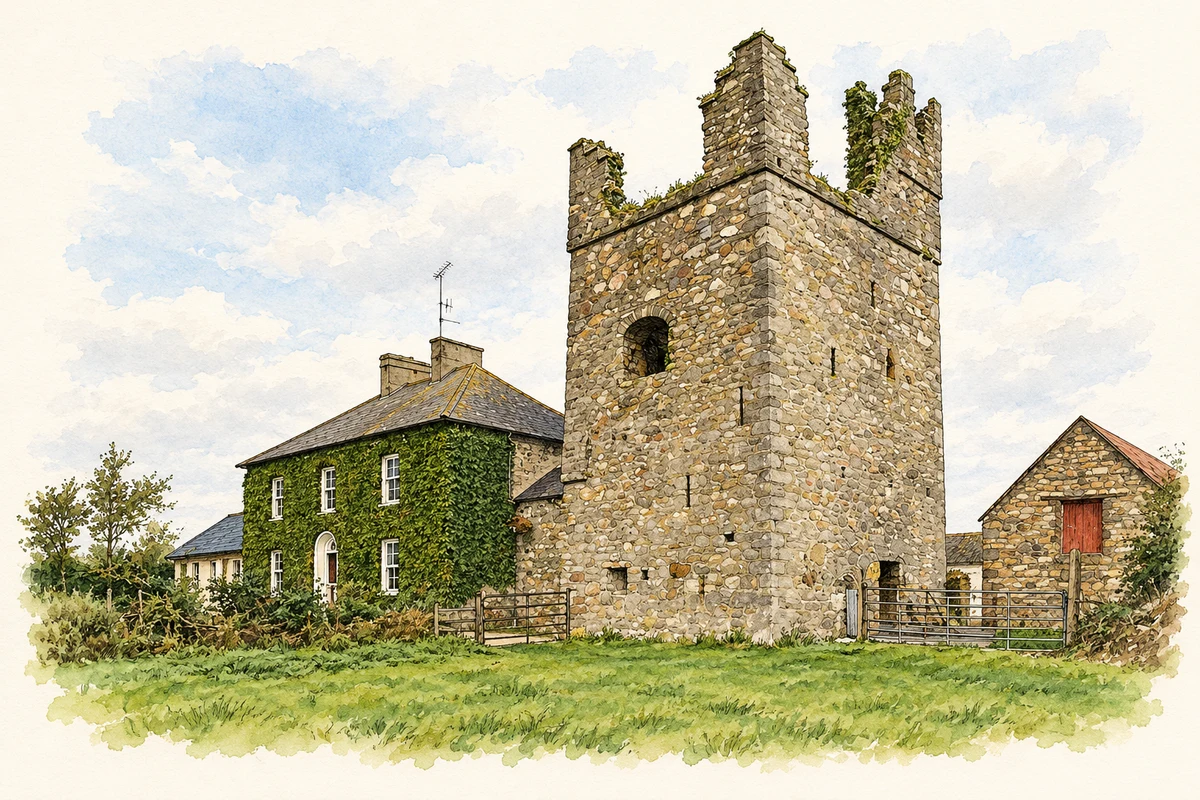
The house attached to Mulrankin Castle was present by 1822. The architectural inventory records a compact two-storey building with thick, sloping walls, a hipped slate roof and paired central chimneys. Outbuildings complete the farm group. The survey connects its later history with the Lambert family, including farmer Walter Lambert in the early twentieth-century censuses. [2]
Medieval features beneath the extension
In 2013, Catherine McLoughlin investigated the footprint of a proposed extension beside the house. Test trenches uncovered large pits or ditches dated to the late twelfth or early thirteenth century, containing locally made pottery and roof tile. The features could remain in place because the proposed floor stood more than a metre above them. [3]
Evidence within a chimney stack
The same investigation monitored the conversion of an existing window into a doorway through a chimney stack. McLoughlin interpreted the house as probably incorporating a medieval hall, with chimneys added around the middle of the seventeenth century. Further remodelling followed after 1840. These remain archaeological interpretations of a building altered over several periods. [3]
Geographic information
Sources & further reading
- Logainm.ie — Bridgetown. Place names and geographic record, licensed under CC BY 4.0.
- Mulrankin Castle farmhouse, NIAH15704723 · National Inventory of Architectural Heritage
- 2013:502, Mulrankin, licence13E0137 · Catherine McLoughlin, Stafford McLoughlin Archaeology; Excavations.ie
- Mulrankin Castle and attached farmhouse, County Wexford, as photographed in October 2013 illustration: based on a Castles of Leinster: Mulrankin, Wexford (1) by Mike Searle. AI-assisted watercolour and ink adaptation; cream paper margins added, incidental clutter omitted and fine details simplified. Licence: CC BY-SA 2.0.
Name record retrieved 2026-10-25 · Source record modified 2025-01-10. How this page was prepared.