 placenames
Slade
An Slaod
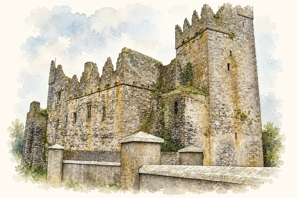
Slade’s castle, stone-roofed annexe and layered harbour walls preserve centuries of coastal building on the Hook peninsula.
The name
A reliable full-name meaning has not been established here. The recorded Irish and English forms are given without an unsupported translation.
Recorded forms
- An Slaod · Irish · main form · validated name
- Slade · English · main form
Place & story
The Laffan family’s tower house
The Laffan family built Slade’s slender, four-storey tower house in the fifteenth century. Its principal room occupied the second floor, with a fireplace and garderobe, while the entrance lobby had a defensive opening in the floor above. In the sixteenth century, a battlemented two-storey house was added at the tower’s northeast corner. An eastern annexe has a corbelled stone roof and may be associated with the salt-making industry that flourished locally during the seventeenth century. [2]
A famine-relief quay on older foundations
The harbour’s nineteenth-century quay was built in 1846–47 to designs by Barry Duncan Gibbons, the Board of Public Works’ engineer for piers and harbours. It combines a rectangular northern pier with an L-shaped southern pier, both constructed with sloping rubble-limestone walls. The project provided famine-relief employment for the people of Hook. The National Inventory of Architectural Heritage considers it likely that the work reused foundations from earlier piers associated with Henry Loftus and William Mansell in the late seventeenth century. [3]
Conserving the harbour walls
A programme reported in 2023 repaired the north and east piers and the southern harbour wall. Stonemasons renewed deteriorated mortar joints and filled gaps in the masonry under archaeological supervision. Monitoring sought to protect existing historic elements and identify any previously unrecorded features. No new architectural features or small finds emerged during the work. The repairs nevertheless preserved the fabric of a harbour whose northern wall is recorded as a monument and probably originated in the late seventeenth century. [4]
Geographic information
Sources & further reading
- Logainm.ie — Slade. Place names and geographic record, licensed under CC BY 4.0.
- Slade Castle · Office of Public Works, Heritage Ireland
- Slade quay: NIAH 15705410 · National Inventory of Architectural Heritage
- 2023:130 Slade Harbour, Wexford, licence 23E 0416 · Colm Moriarty, Excavations.ie
- Slade Castle, County Wexford illustration: based on a Slade Castle [1] by Michael Dibb. AI-assisted watercolour and ink adaptation; cream paper margins added, incidental clutter omitted and fine details simplified. Licence: CC BY-SA 2.0.
Name record retrieved 2026-10-25 · Source record modified 2026-07-31. How this page was prepared.