 placenames
O'Brien's Bridge
Droichead Uí Bhriain
O’Brien’s Bridge developed at a Shannon crossing; its later history includes canal towpaths, a contested bridge location and a heritage garden.
The name
These Irish name elements are associated with this record in the Logainm glossary.
An element’s translation is a clue, rather than a complete explanation of the name. Its form and meaning depend on local history and the full Irish name.
Recorded forms
- Droichead Uí Bhriain · Irish · main form · validated name
- O'Brien's Bridge · English · main form
Place & story
The crossing and the village
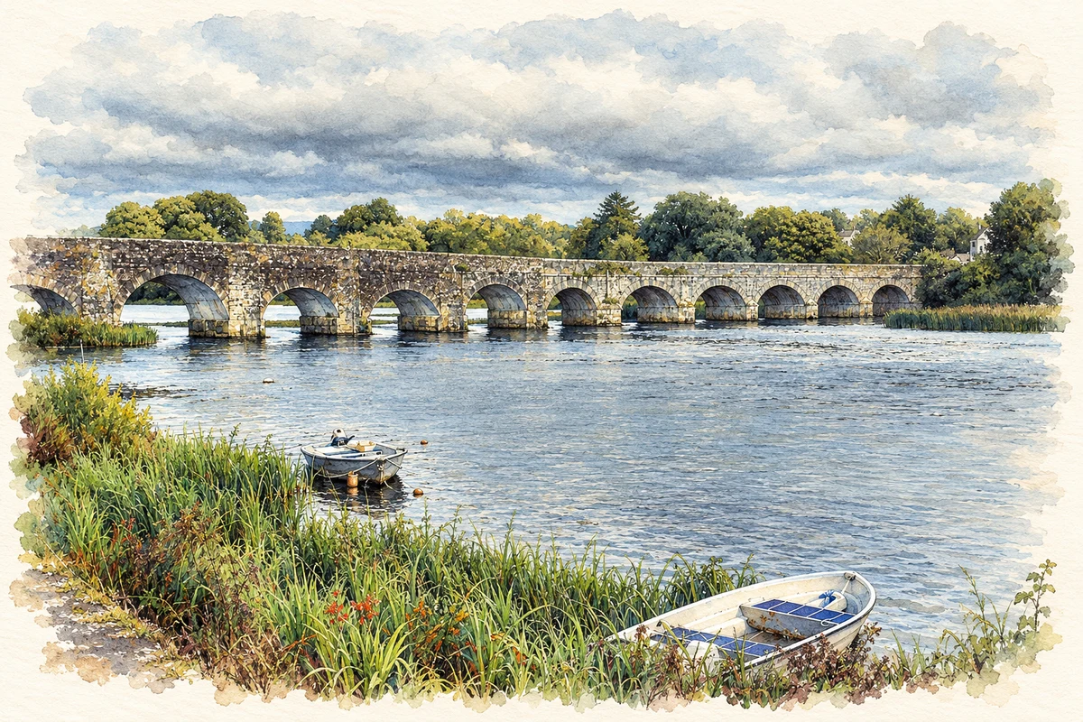
A bridge built by Turlough O'Brien in 1506 gave the village its later name. The present crossing belongs to a later phase: Clare Heritage records eighteenth-century construction followed by alteration in the 1840s to accommodate vessels. Passengers and freight moving between Limerick and Dublin brought business to the riverside settlement. The bridge's history is therefore a succession of crossings and adaptations, not a single structure surviving unchanged from 1506. [2]
The bridges of the towpath
Humpback bridges south of the village preserve details of horse-drawn navigation. Their river-side parapets are lower than those on the land side, allowing towing ropes to pass without obstruction while horses crossed. Built in sandstone for the canal company, they also allowed livestock to reach the river. This small architectural difference records the practical relationship between the towpath, barges and adjoining farmland. [2]
The 1927 bridge-location campaign
The Shannon hydroelectric scheme's new headrace canal cut across established roads. In 1927 residents objected to a proposed bridge at Knockadrehid, which would lengthen journeys to Bridgetown's church, school and creamery. A submission to industry minister P. J. McGilligan argued for the Bridgetown Road instead. The community heritage project preserves the submission and records that residents succeeded. The bridge's position was thus shaped by a local campaign over everyday access as well as by the engineering requirements of electricity generation. [3]
Remembering Nan Hogan
The Heritage Garden beside the bridge is dedicated to Nan Hogan, a leading Cumann na mBan member who died in 1924. Older agricultural equipment, including a plough and mowing machine, is displayed there. The garden brings political commemoration and farming heritage together at the village's main crossing, giving a public place to two different strands of local memory. [2]
Geographic information
- Place type
- Town
- County
- Clare
- Barony
- Tulla Lower
- Coordinates
- 52.75306, -8.50361 (approximate)
- Logainm ID
- 1413978 ↗
Sources & further reading
- Logainm.ie — O'Brien's Bridge. Place names and geographic record, licensed under CC BY 4.0.
- O’Briensbridge Heritage · Joe McArthur, County Clare Heritage Office
- Location of bridge at O’Briensbridge · Peggy Ryan, Clonlara Community Heritage
- O'Brien's Bridge over the River Shannon, County Clare illustration: based on a Bridging time and space by Liam Moloney. AI-assisted watercolour and ink adaptation; cream paper margins added, incidental clutter omitted and fine details simplified. Licence: CC BY-SA 2.0.

Name record retrieved 2026-10-25 · Source record modified 2025-01-10. How this page was prepared.