 placenames
Noughaval
Nuachabháil
A church brought from Ballyvaughan and an octagonal stone preserve different strands of the settlement’s history.
The name
These Irish name elements are associated with this record in the Logainm glossary.
An element’s translation is a clue, rather than a complete explanation of the name. Its form and meaning depend on local history and the full Irish name.
Recorded forms
- Nuachabháil · Irish · main form · non-validated name
- Noughaval · English · main form
Place & story
A church moved across the Burren
Saint Mochua’s Catholic Church was originally a Church of Ireland building at Ballyvaughan. It was dismantled and reconstructed at Noughaval in 1943. The architectural inventory records limestone walls, narrow pointed windows, a gabled entrance porch and a stone bellcote. Its six-bay side elevations and projecting sacristy belong to a building whose present location and Catholic use resulted from relocation, rather than construction from scratch on this site. [2]
The stone beside the graveyard
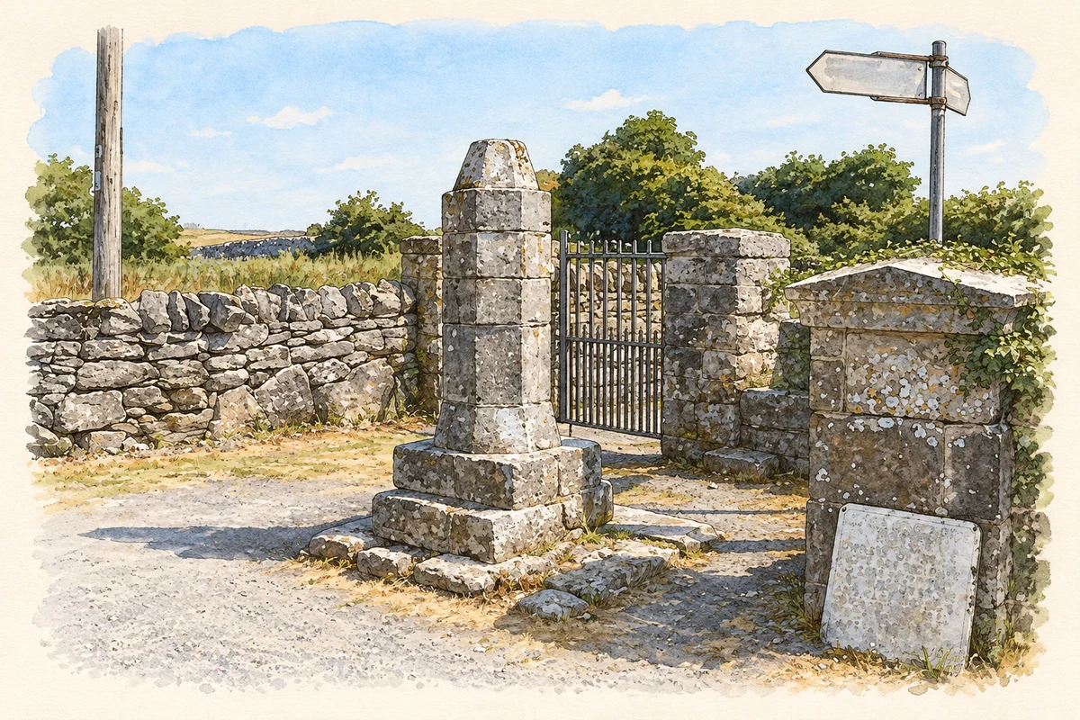
The monument catalogued as Noughaval Cross is an octagonal stone pier on a stepped base, topped by a tapering cap. The architectural inventory describes it as a market stone and assigns an approximate date of 1725. That assessment concerns the surviving monument; it does not establish when a market first operated here. [3]
Flax and animals in local recollection
Writing in 2021, Bernadette O’Halloran reported speaking with local people about the stone. Their accounts associated it with measuring and trading prepared flax, and with tethering donkeys or ponies while their owners attended Mass. These are recorded local traditions about its uses. Her account also acknowledges the absence of documents dating the market’s beginning or end. [4]
Geographic information
Sources & further reading
- Logainm.ie — Noughaval. Place names and geographic record, licensed under CC BY 4.0.
- Saint Mochua’s Catholic Church, record20400901 · National Inventory of Architectural Heritage
- Noughaval Cross, record20400909 · National Inventory of Architectural Heritage
- Medieval Church and Settlement of Noughaval · Bernadette O’Halloran, County Clare Heritage Office, 2021
- Noughaval Market Stone, County Clare, as photographed in July 2013 illustration: based on a Noughaval Market Stone by Oliver Dixon. AI-assisted watercolour and ink adaptation; cream paper margins added, incidental clutter omitted and fine details simplified. Licence: CC BY-SA 2.0.
Name record retrieved 2026-10-25 · Source record modified 2021-10-29. How this page was prepared.