 placenames
Ruan
An Ruán
Dromore’s surviving tower-house and Hugh Brady’s school recall different forms of local influence.
The name
A reliable full-name meaning has not been established here. The recorded Irish and English forms are given without an unsupported translation.
Recorded forms
- An Ruán · Irish · main form
- Ruan · English · main form
Place & story
An O’Brien castle on a former island
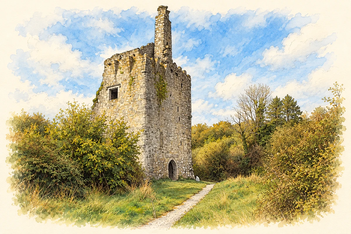
Dromore Castle once stood on a small island in Dromore Lake, later joined to the mainland. Its doorway inscription names Teige, son of Connor, third Earl of Thomond, and Teige’s wife Slany Brien as its builders. The ruined limestone tower-house now forms part of the Dromore Wood Nature Reserve, placing an earlier residence within a later protected woodland landscape. [2]
Surviving rooms and later alterations
The castle’s east doorway led past a guardroom into the ground-floor chamber. Upper floors have largely disappeared, but a garderobe, pointed doorway and decorated window openings remain. Brickwork around an upper doorway and a brick fireplace indicate rebuilding. The surviving parapet includes a wall-walk and a projecting bartizan, preserving defensive features alongside evidence of alterations to the living accommodation. [2]
Hugh Brady’s examination pupils
Hugh Brady, born around 1844, became Ruan National School’s principal while still a young man. Clare Libraries records his reputation from the early 1870s as a coach for Civil Service examinations. Pupils came from across Munster to study at the school. This specific educational role brought Ruan connections beyond its immediate farming district, before Brady’s death in 1918. [3]
Geographic information
Sources & further reading
- Logainm.ie — Ruan. Place names and geographic record, licensed under CC BY 4.0.
- Dromore Castle · Office of Public Works, Heritage Ireland
- Ruan National School: roll books and historical introduction · Clare Libraries Local Studies
- Dromore Castle in Dromore Wood, County Clare, as photographed in October 2009 illustration: based on a Castles of Munster: Dromore, Clare by Mike Searle. AI-assisted watercolour and ink adaptation; cream paper margins added, incidental clutter omitted and fine details simplified. Licence: CC BY-SA 2.0.
Name record retrieved 2026-10-25 · Source record modified 2022-07-18. How this page was prepared.