County

Tipperary

Tiobraid Árann

The Suir valley’s castles and Charles Kickham’s writing offer distinct views of power, work and community in Tipperary.

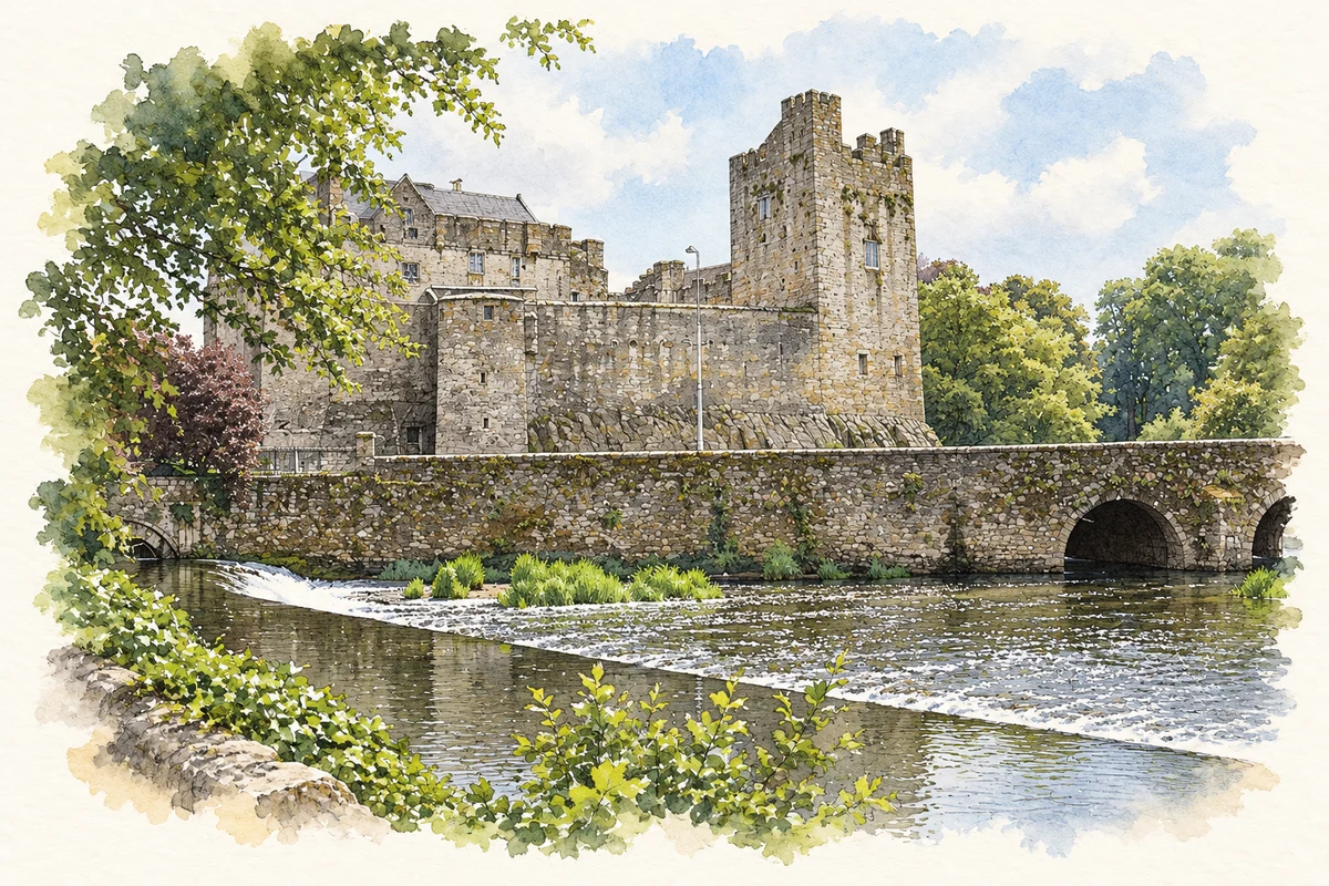
Watercolour and fine ink illustration of Cahir Castle beside the River Suir in County Tipperary.
Illustration, Cahir Castle beside the River Suir
Recorded locationTipperary52.63172° N · 7.94091° WInteractive map supplied by OpenStreetMap.
Recorded place location · Logainm.ie

The name

A reliable full-name meaning has not been established here. The recorded Irish and English forms are given without an unsupported translation.

Recorded forms

  • Tiobraid Árann · Irish · main form · validated name
  • Tipperary · English · main form

Place & story

Uplands and working waterways

Tipperary’s landscape includes the Silvermines, Arra, Galtee, Knockmealdown and Slieveardagh ranges, with Lough Derg and Shannon wetlands in the northwest. Lewis’s Nenagh account describes a crossroads market linked towards Dromineer and Lough Derg. His Clonmel entry follows the Suir, with commercial activity on a river that also connected the town to County Waterford. [2] [3] [4]

Artillery against Cahir Castle

Cahir Castle stands on a rocky island in the Suir. Built in the thirteenth century and later a Butler stronghold, it commanded an important river setting. Its defences fell to the Earl of Essex in 1599 when heavy artillery was deployed against them. Further sieges followed during the Confederate Wars. The substantial surviving structure preserves a long history of defensive design and its testing by changing weapons. [5]

People & connections

Charles Kickham and Mullinahone

Charles Kickham’s family life and literary identity were closely tied to Mullinahone. A childhood gunpowder accident permanently damaged his hearing and eyesight. He later worked as a Fenian journalist, becoming a joint editor of the Irish People in 1863. Released from prison on compassionate grounds in 1869, he returned to Mullinahone. His writing emerged from political commitment, personal hardship and close attention to the small farming and rural communities he knew. [6]

The homes of Tipperary in print

Kickham’s Knocknagow, or The Homes of Tipperary appeared in 1873 and became widely read. Its scenes of local life sit beside criticism of forces driving small farmers and cottiers from their homes. His earlier novel Sally Cavanagh had appeared in 1869. These books belong to the county’s literary history: they show how a writer associated with a particular town used fiction to represent a threatened rural society. [6]

Geographic information

Place type
County
County
Tipperary
Coordinates
52.63172, -7.94091
Mapped area
4,305.16 km²
Logainm ID
100029 ↗

Population over time

County Tipperary, including its cities

County population, 1841–2022

167,895people · 2022

0125K250K375K500K 1841: 435,553 people18411851: 331,567 people1861: 249,106 people1871: 216,713 people1881: 199,612 people1891: 173,188 people1901: 160,232 people19011911: 152,433 people1926: 141,015 people1936: 137,835 people1946: 136,014 people1951: 133,313 people19511956: 129,415 people1961: 123,822 people1966: 122,812 people1971: 123,565 people1979: 133,741 people1981: 135,261 people1986: 136,619 people1991: 132,772 people1996: 133,535 people2002: 140,131 people2006: 149,244 people2011: 158,754 people2016: 159,553 people2022: 167,895 people2022

Figures cover the whole county including its cities. CSO recommends this series for long-term comparison, although minor boundary changes have occurred.

View population figures
County Tipperary, including its cities — census population
Census yearPopulation
1841435,553
1851331,567
1861249,106
1871216,713
1881199,612
1891173,188
1901160,232
1911152,433
1926141,015
1936137,835
1946136,014
1951133,313
1956129,415
1961123,822
1966122,812
1971123,565
1979133,741
1981135,261
1986136,619
1991132,772
1996133,535
2002140,131
2006149,244
2011158,754
2016159,553
2022167,895

Source: CSO F1001 — Population at Each Census. CC BY 4.0. Retrieved 2026-10-25.

People & family history

Census figures refer to the matched historical census area for each year. Boundaries and spellings can change over time.

Explore this county

Up to 50 places per page, ordered by name.

Sources & further reading

  1. Logainm.ie — Tipperary. Place names and geographic record, licensed under CC BY 4.0.
  2. Nenagh — A Topographical Dictionary of Ireland (1837) · Samuel Lewis · 1837
  3. Clonmel — A Topographical Dictionary of Ireland (1837) · Samuel Lewis · 1837
  4. Strategic Environmental Assessment Environmental Report, September 2023 · Tipperary County Council
  5. Cahir Castle · Office of Public Works
  6. Kickham, Charles Joseph · William Nolan, Dictionary of Irish Biography
  7. Boundary geometry retains its source attribution and licence in the downloadable geographic record. Map tiles © OpenStreetMap contributors.
  8. Cahir Castle beside the River Suir illustration: based on a Cahir Castle by Mike Searle. AI-assisted watercolour and ink adaptation; cream paper margins added, incidental clutter omitted and fine details simplified. Licence: CC BY-SA 2.0.

Name record retrieved 2026-10-25 · Source record modified 2025-01-10. How this page was prepared.